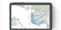
StormGeo's shipping division (formerly AWT), a provider of fleet optimization services, fleet performance and onboard voyage management software, has introduced a new multi-model technology enabling ship captains to make better routing decisions around tropical cyclones. StormGeo's Tropical Cyclone track uses multi-model ensembles and advanced analysis to narrow the "cone of uncertainty," the area extending out from a storm on a forecasting map that projects a cyclone's path.
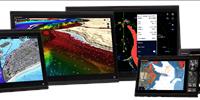
In order to improve decision-making for crew and cargo safety, the new Tropical Cyclone Multi-Model (TCMM) track technology is included in the latest versions of the onboard BVS and Routing Advisory Service. In addition, StormGeo's clients will also receive color-coded graphics, four times a day, to quickly assess where the most likely tracks will occur.
"Understanding the likelihood of encountering a tropical cyclone on a given shipping route days in advance of the occurrence and having the benefit of time necessary to navigate away from the dangerous situation are vital for safe operations," said Richard Brown, StormGeo ship operations CEO. "With our new technology, captains have information to help them make better decisions in the face of inherently erratic weather conditions."
The industry-standard "cone of uncertainty" concept was generated by The National Hurricane Center (NHC) using historical data to demonstrate forecast error. However, this method is limited in its ability to display multiple possible tracks because the cone dimensions do not vary based on forecast uncertainty or confidence level, according to StormGeo, who said its TCMM technology offers significant improvement, indicating the most likely path of a tropical cyclone and providing a range of possible alternate routes.
"Our customers rely on StormGeo for the most innovative products in the industry, and our new technology delivers on our promise," Brown said. "The data on which the system is built was collected from four major weather agencies' ensembles, and 94 algorithms were created to parse the data into one multi-model ensemble. This is a leading edge, advanced weather and navigational achievement with great potential for improving shipping safety."