010-10800-72 Bluechart G2 Map Update
Model: 010-10800-72 Brand: Garmin
Garmin has created an update for units preloaded with BlueChartr g2 U.S. coastal maps. This update will provide customers with the newest charting additions and Notice to Mariners changes available, including navaids, port plans, depth contours, fishing contours, spot soundings and more. The update card will also contain a software update for Garmin devices. The software update must be performed on the device before the update map will work. Also please note that the card must remain in the device to view updated maps. The card does not overwrite the unit's internal maps. Features: Provides basic chart navigation with 2-D or 3-D over the bow view map perspective Includes tides, currents, marine points of interest (POIs) and IALA symbols Displays port plans, fishing contours and standardized depth contours « less
Product Specification
-
Universal Product Identifiers
Part Numbers: 010-10800-72, 38847, GAR0101080072GTIN: 00753759102524
Related Products
-
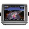
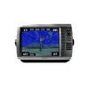
GPSMAP 7012 GPS Chart Plotter Mfd 11068541
-
061 15 Parallel Rules
-
20ft 24AWG Cat6 550mhz UTP Ethernet Bare Copper Network Cable - Purple
-
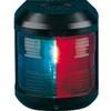
Navigation Light for Bulk Head mounting, Port
-
Audiopipe Ip2rca12 2 Ch Marine Oxygen Free RCA Cable 12 ft 2 Channel
-
Cat6a Ethernet Cable | 7ft | Blue | Network | 10 Gigabit
-
Marine 9-44003: Marine Hose Connectors
-
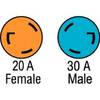
F3020ADSS Adapter,30A M to 20A F
-
Connector Kit for 3/8 Inch LED Rope Light - Imt-ilmdl-con12v-l6
-
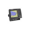
GPSMAP 4012 - Marine GPS receiver - 10.4" color - 800 x 600
-
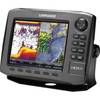
000-10537-001 HDS-8 Gen2 Insight USA 83200khz Marine Electronics
-
GlobalMap 3600C iGPS - Marine GPS receiver - 5" color - 480 x 480