010-C0747-20 Bluechart G2 HXAF001REastern Africa Microsd/sd ADA
Model: 010-C0747-20 Brand: Garmin
General coverage of the east coast of Africa from the Gulf of Tadjoura to the Bay of Maputo, including Mogadishu, Som., Mombasa, Ken., and Dar es Salaam, Tan. Also includes general coverage of the entire coast of Madagascar. Includes detailed coverage of Djibouti, Dji., Maputo, Moz., Mauritius, Reunion, and the Seychelles. See your surroundings more clearly with BlueChart g2 data. With BlueChart g2, you'll get detailed marine cartography that provides convenient viewing of nautical content. BlueChart g2 allows you to see your vessel's precise, on-chart position in relation to naviads, coastal features, anchorages, obstructions, waterways, restricted areas and more. You will also have access to detailed mapping capabilities that include Safety Shading , Fishing Charts , smooth data transition between zoom levels, harmonious transition across chart borders, and reduction of chart discontinuities. « less
Product Specification
-
Universal Product Identifiers
Part Numbers: 010-C0747-20, 10804540, 35576GTIN: 00753759089641
Related Products
-
U1-CHRT-PRO Chartmaster Pro Combo - External
-
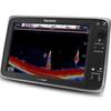
E127 Multifunction 12" Display with Sonar - aus, NZ, S. America, Asia Charts T70055 c44355
-
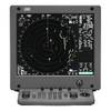
JMA-5312-6 Radar 96 NM with 6' Open Array & 19 Inch LCD Monitor
-
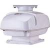
RSB0073-087 24/48 rpm Gearbox with 25.0 KW Transceiver (FR8252)
-
HPWIC3 Map, Wisconsin, Electronic Chart
-
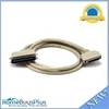
7ft 24AWG Cat6 500mhz Crossover Ethernet Bare Copper Network Cable - Orange
-
3ft USB 2.0 A Male to B Male 28/24AWG Cable - (Gold Plated)
-
1.5ft Premier Series XLR Female to 1/4inch TRS Male 16AWG
-
741 HPDB50 M/CN50 M SCSI Cable , 25pr - 6ft
-
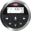
CMRC1-BSS Marine CD receiver remote control unit
-
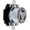
Wiring Device-Kellems HBL63CM69 50A 125/250V 3P4W Marine Twist-Lock Receptacle
-
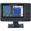
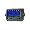
GPSMAP 4210 - Marine Chartplotter - 10.4" color - 800 x 600