010-C0763-10 Bluechart G2 HEU004RIrish Sea Data Card
Model: 010-C0763-10 Brand: Garmin
British coast: covers from Port Ellen on the Isle of Islay to Falmouth, including the Isle of Man and the Isles of Scilly. Irish coast: covers from Sheep Haven to Caherciveen, Republic of Ireland, including Londonderry, The Storks, Belfast, and Dublin. See your surroundings more clearly with BlueChart g2 data. With BlueChart g2, you'll get detailed marine cartography that provides convenient viewing of nautical content. BlueChart g2 allows you to see your vessel's precise, on-chart position in relation to naviads, coastal features, anchorages, obstructions, waterways, restricted areas and more. You will also have access to detailed mapping capabilities that include Safety Shading , Fishing Charts , smooth data transition between zoom levels, harmonious transition across chart borders, and reduction of chart discontinuities. « less
Product Specification
-
Universal Product Identifiers
Part Numbers: 010-C0763-10, 10804839, 35599GTIN: 00753759091491
Related Products
-
SP110RF-6 SP-110 System w/Rudder Feedback & Mechanical Remote D
-
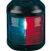
Navigation Light for Bulk Head Mounting , Masthead
-
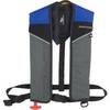
Sospenders 1431 24G A/M Easy Repack Inflatable Vest Blue
-
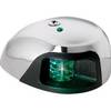
3550G7 LED Navigation Light Green
-
1447 3ft Optical Toslink 5.0mm OD Audio Cable
-
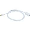
3ft 32AWG Mini DisplayPort Male to Female Extension Cable - White
-
HBL63CM65 Male Plug 50A 125/250V Ship-to-Shore
-
55-0023 Transom Adaptor - 550012/21/22
-
Park Power 50 Amp (F) to 30 Amp (M) RV Adapter - 1'
-
010-11095-00 NMEA 2K Female Connector
-
GPS 152H - Marine GPS receiver - 4" monochrome - 100 x 160
-
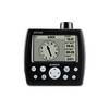
RINO 120 - Hiking GPS receiver / two-way radio - Monochrome