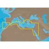
010-C0787-20 Bluechart G2 HXEU051RLista - Sognefjorden microSD
Model: 010-C0787-20 Brand: Garmin
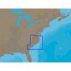
See your surroundings more clearly with BlueChart g2 data. With BlueChart g2, you'll get detailed marine cartography that provides convenient viewing of nautical content. BlueChart g2 allows you to see your vessel's precise, on-chart position in relation to naviads, coastal features, anchorages, obstructions, waterways, restricted areas and more. You will also have access to detailed mapping capabilities that include Safety Shading, Fishing Charts, smooth data transition between zoom levels, harmonious transition across chart borders, and reduction of chart discontinuities. Covers: Detailed coverage of the Norway coast from Farsund to Sognefjorden, including the Shetland Islands. Includes detailed coverage of Bergen, Haugesund and Stavanger. « less
Product Specification
-
Universal Product Identifiers
Part Numbers: 010-C0787-20, 10805356, 35646GTIN: 00753759091965
Related Products
-
15342 Chart Master 169CS Wide Screen Chart Plotter
-
E70014 C127 Multifunction Display W Sonar - No Preloaded Ch
-
Elite 5 DSI - Fishfinder - included transducer : Skimmer DSI
-
Paper Charts ChartKit Book w/ Companion CD - Pacific Northwest 32507
-
NA-C310 Furuno FP Format - Cape May - Winyah Bay
-
EM-M112 C-Card Format Aegean Sea
-
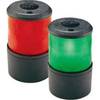
Base Mount All Round Navigation Lights Light, Green
-
2ft 24AWG Cat5e 350MHz UTP Bare Copper Ethernet Network Cable - Yellow
-
50ft 18AWG CL2 Rated 2-Conductor Loud Speaker Cable (for In-Wall Installation)
-
6812 Vision Series Modular System Mount / Pedestal
-
Serial cable - (DB-37) - M - (DB-37) - F - 10 ft - PC
-
Memory Map Adventurer 3500 GPS - Marine Plus OS Mapping, Yellow/Black