010-C1002-20 Bluechart G2 HXEU059RGreenland East Microsd/sd ADA
Model: 010-C1002-20 Brand: Garmin
See your surroundings more clearly with BlueChart g2 data. With BlueChart g2, you’ll get detailed marine cartography that provides convenient viewing of nautical content. BlueChart g2 allows you to see your vessel’s precise, on-chart position in relation to naviads, coastal features, anchorages, obstructions, waterways, restricted areas and more. You will also have access to detailed mapping capabilities that include Safety Shading, Fishing Charts, smooth data transition between zoom levels, harmonious transition across chart borders, and reduction of chart discontinuities. Covers: Detailed coverage of the Eastern coast of Greenland from Germania Land around the southern tip of Greenland to Godthab (Nuuk) on the SW coast: Also details Jameson Land, Ammassalik, Julianehab (Qaqortoq), and Nanortalik. « less
Product Specification
-
Universal Product Identifiers
Part Numbers: 010-C1002-20, 10807212, 35804GTIN: 00753759090340
Related Products
-
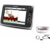
Package(c97 with aus, NZ, S. America, Asia Chart, 4KW 18 Inch Digital Radome & Radar Cable)
-
ICE 35 - Fishfinder - portable - included transducer : XI 9 19 - dual-beam
-
Marine Navigation: Piloting and Celestial and Electronic Navigation [Book]
-
GHP10V Autopilot
-
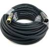
High Performance Marine Heading Sensor NMEA 0183 Cable
-
LED Navigation Lights, Masthead Tricolor w/ Anchor 65 ft
-
50ft Premier Series XLR Male to XLR Female 16AWG Cable (Gold Plated) [Microphone & Interconnect]
-
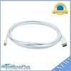
10ft 32AWG Mini DisplayPort to DisplayPort Cable - White
-
1- Light Bar for 18" or Smaller SatDomes - Requires Ltb Top, LTB-S
-
Whisper Whi-500 230V, 3 KW (24Mph Wind) Wind Turbine with Controller
-
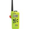
2829 SR203 VHF GMDSS Survival Radio
-
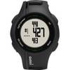
Approach S1W - Golf GPS receiver - 1" monochrome - 64 x 32