010-C1020-20 Bluechart G2 HXPC024RAustralia & New Zealand
Model: 010-C1020-20 Brand: Garmin
See your surroundings more clearly with BlueChart g2 data. With BlueChart g2, you'll get detailed marine cartography that provides convenient viewing of nautical content. BlueChart g2 allows you to see your vessel's precise, on-chart position in relation to naviads, coastal features, anchorages, obstructions, waterways, restricted areas and more. You will also have access to detailed mapping capabilities that include Safety Shading, Fishing Charts, smooth data transition between zoom levels, harmonious transition across chart borders, and reduction of chart discontinuities. Covers: Detailed coverage of the entire continent of Australia and New Zealand. Coverage includes Brisbane, Sydney, and the Great Barrier Reef along the Eastern coast. Coverage continues along the Southern coast including Melbourne, Adelaide, and Tasmania through the Great Australian Bight. Coverage also includes Perth, Geraldton, Darwin, and the Gulf of Carpentaria on the Western and Northern coasts. « less
Product Specification
-
Universal Product Identifiers
Part Numbers: 010-C1020-20, 10807238, 35814GTIN: 00753759095499
Related Products
-
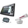
Package(E140W, GPS Antenna, DSM300G Sounder, RA1048D 4KW 48 Inch HD Digital Open Array Radar & 15m Radar Cable )
-
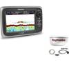
Package(e7D with Sonar & aus, NZ, S. America, Asia Chart, 4KW 18 Inch Digital Radome & Radar Cable)
-
2680 Nauticast Class B AIS System W/ANTENNAS & Cables
-
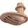
0065DP4PLB 1/2 Scoop Thru Hull w/Nut
-
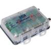
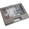
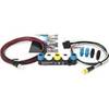
SY-ACC65060 130 Piece Networking & Telephone Installation Toolkit
-
407870-1 Ice 345C
-
USB 2.0 A Male to Micro-B Male Cable 10 ft.
-
10ft DB 9 F/F Molded Cable
-
E22158 SeaTalk 1 to SeaTalk NG Converter Kit
-
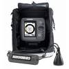
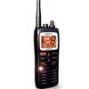
MHS125 Floating HH VHF
-
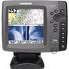
700 Series 798ci SI Combo NVB - Marine Chartplotter - 5" color - 640 x 640
-
protective Cover Marine GPS