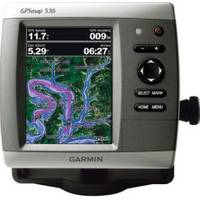
0100077300 Gpsmap536 Plotter
Model: Gpsmap536 Brand: Garmin
Mfr: Garmin - 100077300; These compact GPS/Chartplotters feature an ultra-bright 5" diagonal color display with a high-speed digital design for faster map drawing and panning speeds. Includes a built-in basemap and an easy-to-use interface to help navigate your waters with ease. Accepts BlueChart g2 Vision cards for added features and functionality like high-resolution satellite imagery, 3-D views, and Auto Guidance Technology. 10-32V DC. Other features include AIS support, DSC position display, audible alarms, tide tables, sun & moon informations, NMEA interface, and more. Standard models are GPS/Chartplotters and do not include fishfinding capabilities. Inland Lake maps. 546/546s include the basemap plus U.S. Coastal maps, including Alaska & Hawaii, as well as detailed Bahamas charts. Transducers for S models sold separately. « less
Product Specification
-
Universal Product Identifiers
Part Number: 100077300
Related Products
-
4G Broadband Radar with 10M Cable 000-10419-001 c42913
-
CFFISHE USA Fish N Chip E on CF
-
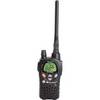
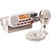
Nautico NT3VP VHF 88-channel Two-way radio
-
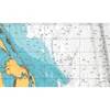
Canadian Charts Qu.Charlot Str.W.Portion/Bull Harb.
-
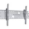
Adjustable Tilting Wall Mount Bracket for LCD LED Plasma (Max 165Lbs, 52~71inch) - Extra Wide - Silver
-
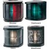
Marine Navigation Lights for Boats to 65'7" Starboard Series
-
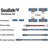
A25062 SeaTalkNG Backbone Cable Kit for ST70
-
100ft 24AWG Cat6 550mhz UTP Ethernet Bare Copper Network Cable - Purple
-
Electronics Mr F45-D Marine Class-D DSC
-
25ft Premier Series XLR Male to XLR Female 16AWG Cable (Gold Plated) [Microphone & Interconnect]
-
14ft 24AWG Cat5e 350MHz UTP Bare Copper Ethernet Network Cable - Blue
-
DA82S 3' Cell Adapter Cable