30128 Max - U.S. Gulf Coast and Inland Rivers - C-Card
Model: 30128 Brand: C-Map
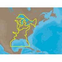
NA-M023 => Gulf of Mexico, Great Lakes and Rivers Coverage of the Gulf states, starting from Boca Raton, FL, down to Key West, FL, then back up and around the Gulf to Brownsville, TX. Also includes coverage of all the Great Lakes: Erie, Superior, Ontario, Huron and Michigan. Coverage of the Great Lakes also includes Fox River and Lake Winnebago, Lake St. Clair and the Trent-Severn Waterway. River coverage includes the Mississippi River, Ohio River, Illinois River, Arkansas River, Red River, Ouachita River, Tennessee River, Cumberland River, Tenn-Tom Waterway and the Black Warrior River. Other smaller rivers are also included: Green River, KY, Kanawha River, WV, Allegheny and Monongahela Rivers, PA and Kankakee River, IL. Additional coverage of the Hudson River, including Lake Champlain, down to New York City, the Erie Barge Canal and partial coverage of the St. Lawrence River up to Montreal. « less
Product Specification
-
Universal Product Identifiers
Part Numbers: 30128, NA-M023, NA-M023.00, NA-M023C-CARDGTIN: 000000165837, 00686074002739
Related Products
-
AP2804VRF Autopilot AP28,AC42,RC42,RPU160
-
SP110RF-6 SP-110 System w/Rudder Feedback & Mechanical Remote D
-
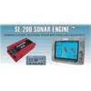
SE200C Sonar engine with 2 Thru Hull Transducers U1-200C-00E 1200c00e
-
CH250BB/88/340 88 kHz Black Box Searchlight Sonar System. Includes 400mm Travel Hoist and Operates at 24 & 32VDC
-
MDS-1 2KW 12 Inch Dome Radar Add-on with 10 Meter Cable wmsd1
-
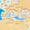
43XG/CF 43XG - Mediterranean Sea & Black CF Card
-
Prod 1.5oz Refill Air Horn 46201
-
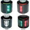
Series 43 Black LED Navigation Light Port
-
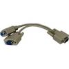
04-1092-000R Standard VGA Cable Splitter
-
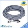
15ft Premium Optical Toslink Cable w/ Metal Fancy Connector
-
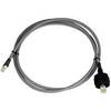
E55051 - SeaTalk hs Network Cable, 10M
-
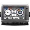
GPSMAP 720s - Marine Chartplotter - 7" color - 800 x 480 - widescreen