How to read a nautical chart: a complete guide to the symbols, abbreviations, and data displayed on nautical charts [Book]
The best handbook on chart usage, from one of the most trusted names in boatingIn 2000, the U.S. government ceased publication of Chart No. 1, the invaluable little book that generations of mariners have consulted to make sense of the complex system of signs, symbols, and graphic elements used in nautical charts. Now Chart No. 1 is not just reborn but expanded and improved in How to Read a Nautical Chart. The demand for a book like this has never been greater.Arranged and edited by Nigel Calder, one of today's most respected boating authors, --and containing four-color illustrations throughout,-- How to Read a Nautical Chart presents a number of original features that help readers make optimum use of the data found in Chart No. 1, including a more intuitive format, crucial background information, international chart symbol equivalents, electronic chart symbology, and thorough explanations of the practical aspects of nautical chart reading. « less
Product Specification
-
Authors: Nigel CalderPages: 237Format: paperbackPublication Date: 2003Key Terms: geoid, chart datum, drying height, IALA, sectored lights, NOAA, Chesapeake Bay, World Geodetic System, buoy, ellipsoid, hydrographic offices, Nautical Chart, Notices to Mariners, RACON, British Admiralty, traffic separation scheme, Retroreflector, Mercator chart, numbers, imperial units
-
Universal Product Identifiers
ISBN: 0071376151GTIN: 09780071376150
Related Products
-
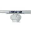
IR2 4.4 4KW 4.5 Foot Open Array Radar R-0006
-
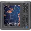
1935 4KW 3.5 Open Array Color LCD Radar 37418
-
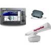
Package(C120W, DSM300G Sounder, RA1048D 4KW 48 Inch HD Digital Open Array Radar & 15m Radar Cable)
-
2-018 Outdoor US Midwest Chart for Endura Series
-
Paper Chart Kit Book Region 04 Ches Bay and Del Bay
-
CFFISHW Map, USA Fish N Chip West & Gulf
-
NT Plus Wide Chart N-NA-C306 Bahamas
-
Fastfind 210 - GPS Personal Locator Beacon, -40C Battery F/ Fastfind
-
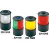
Orca Green Marine LED Tri-Color Anchor / Strobe Navigation Light
-
Base Mount All Round Navigation Lights Light, Red
-
Connector Oildyne Later Prestolite Pumps
-
GPSMAP 740s - Marine Chartplotter - 7" color - 800 x 480 - widescreen