Hydrographical Surveying. a Description of the Means and Methods Employed in Constructing Marine Charts. [Book]
Title: Hydrographical Surveying. A description of the means and methods employed in constructing marine charts.Publisher: British Library, Historical Print EditionsThe British Library is the national library of the United Kingdom. It is one of the world's largest research libraries holding over 150 million items in all known languages and formats: books, journals, newspapers, sound recordings, patents, maps, stamps, prints and much more. Its collections include around 14 million books, along with substantial additional collections of manuscripts and historical items dating back as far as 300 BC.The GEOLOGY collection includes books from the British Library digitised by Microsoft. The works in this collection contain a number of maps, charts, and tables from the 16th to the 19th centuries documenting geological features of the natural world. Also contained are textbooks and early scientific studies that catalogue and chronicle the human stance toward water and land use. Readers will further enjoy early historical maps of rivers and shorelines demonstrating the artistry of journeymen, cartographers, and illustrators. ++++The below data was compiled from various identification fields in the bibliographic record of this title. This data is provided as an additional tool in helping to insure edition identification: ++++ British Library Wharton, K.C.B.; 1882. vii. 360 p.; 8 . 10498.c.14. « less
Product Specification
-
Authors: K. C. B. WhartonPages: 420Format: paperbackPublication Date: 2011.03
-
Universal Product Identifiers
ISBN: 1241386935GTIN: 09781241386931
Related Products
-
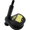
AP5001 Autopilot with AP50, J50 (12 Amps), Rudder Feedback RF300
-
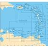
A29 Imray Dominica Marine Nautical Chart
-
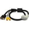
010-11091-00 Marine Audio/Video Cable, Right Angle
-
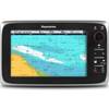
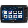
T70026 C95 Multifunction Display w/US Inland Charts
-
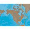
NAM033SD Mega Wide Atlantic CST & Carib
-
Rlb27/35 Cat 1 Mount BKT (No HYDRO)
-
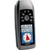
GPSMAP 78s - Marine, hiking GPS receiver - 2.6" color - 160 x 240
-
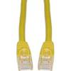
Cat6a Ethernet Cable | 2ft | Yellow | Network | 10 Gigabit
-
200-016 - 2*180 Degree Red - LED Navigation Light
-
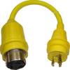
30 Amp to 20 Amp, 125 Volt Straight Adapter, Yellow A3020S
-
E127 12" Display w/ Sounder and US Coastal Charts
-
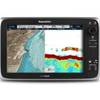
C127 Multifunction Display w/Sonar - US Coastal Charts Map