Hydrographical Surveying; A Description of Means and Methods Employed in Constructing Marine Charts [Book]
This historic book may have numerous typos and missing text. Purchasers can download a free scanned copy of the original book (without typos) from the publisher. Not indexed. Not illustrated. 1882 edition. Excerpt: ...time after it, and adding a certain correction to each altitude to make it equal to the meridian altitude, and thus get a mean meridian altitude, which, if we can calculate the correction exactly, will be of much more value than actual observation on the meridian only. There remain the other errors, some of which may be directly allowed for, but only approximately; others cannot be corrected at all, and the latitude resulting from observations of a single body, as e.g. the sun, will be therefore always more or less in error. The only way satisfactorily to clear these errors is to ob-Pairs of serve stars, in pairs, of as equal altitude as can be found, one 8tTMi north, and one south, of the zenith. These errors will then act in opposite directions, as everything tending to increase or diminish the altitude on one side of the zenith, will act similarly on the other; but, in working out the latitude, the resulting error will increase the latitude in one case, and decrease it in the other, so that the mean of the latitudes obtained by each star of such a pair will approximate very closely to the correct one. To eliminate the artificial horizon roof error when observing pairs of stars, the roof must always be in the same position with respect to the observer, and therefore must be reversed when changing from face north to face south, and vice versd. If observing a single object, as the sun, the roof must be reversed when halfway through the observation. The use of a sextant stand, when once the observer has got Sextant thoroughly accustomed to it, is an immense assistance to good 8tftndobservations, as the images of the stars, instead of quavering and shaking with every slight motion of the hand of the observer, remain perfectly still, and can be made... « less
Product Specification
-
Authors: William James Lloyd WhartonPages: 106Format: paperbackPublication Date: June 29, 2012
-
Universal Product Identifiers
ISBN: 123658774XGTIN: 09781236587749
Related Products
-
Package(E140W, GPS Antenna, 4KW 18 Inch Digital Radome & Radar Cable )
-
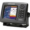
000-10515-001 HDS-5 Gen2 Lake Insight 83200khz Marine Electronics
-
Inc MSD/PREM-N6 Map, HotMaps Premium North
-
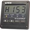
SP110VF-1 Autopilot with Virtual Feedback and No Drive Unit - A
-
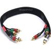
1.5ft 18AWG CL2 Premium 5-rca Component Video/audio Coaxial Cable (RG-6/U) - Black
-
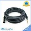
35ft Premier Series XLR Male to 1/4inch TRS Male 16AWG Cable (Gold Plated)
-
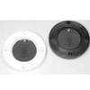
Flush Mount Scupper Adapters, Flush Mount Scupper Adapter White th
-
(1) 100 Amp 125/250 Volt Connector to (2) 50 Amp
-
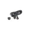
Marine network cable
-
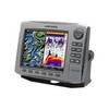
HDS-8 - Marine Chartplotter - 8" color - 800 x 600
-
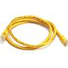
3ft 24AWG Cat6 550mhz UTP Ethernet Bare Copper Network Cable - Yellow
-
AIS Network Dual Channel Rcvr w/GPS