BlueChart g2 - The Netherlands (HEU018R) - Maps
Model: HEU018R Brand: Garmin
BlueChart g2 features crisp labeling and an overall smoother presentation on your chartplotter display. In addition to the basic charts, tidal stations, currents, depth contours, IALA symbols and included fishing charts, BlueChart g2 offers improved transitioning between zoom levels and more seamless continuity across chart boundaries. BlueChart g2 also adds safety shading which allows the user to enable contour shading for all depth contours shallower than the user-defined safe depth. The fishing charts are designed to emphasize bathymetric contours with less visual clutter on the display. « less
Product Specification
-
General
Product Type: MapsDistribution Media: microSD Memory CardBundled with: SD Card adapterFirst Seen On Google Shopping: December 2010 -
Universal Product Identifiers
Part Numbers: 010-C0775-20, The Netherlands (HEU018R)GTIN: 00753759091743
Related Products
-
AP50 Autopilot System Pack 1 with AP50, J50 (12 Amps), Rudder Feedback RF300 & RC25 Compass
-
DSM250 Combo Depth & GPS with Display & Cable Black Pkg-15B
-
IC-M604 VHF Marine Transceiver
-
NAVPILOT 720 Autopilot HH Inboards No Pump
-
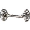
Cabin Door Hook, Bronze, 2-1/2"
-
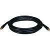
10ft RG6 (18AWG) 75OHM, Quad Shield, CL2 Coaxial Cable with F Type Connector - Black
-
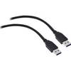
USB 3.0 Cable | Black | 3ft | Type A to Type A | Male/Male
-
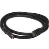
5ft 24AWG CL2 High Speed HDMI Cable w/ Net Jacket - Black
-
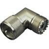
329955-1 UHF Right Angle Connector
-
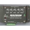
Energy ME-AGS Automatic Generator Start
-
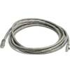
10ft 24AWG Cat5e 350MHz UTP Bare Copper Ethernet Network Cable - Gray
-
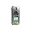
GPSMAP 76CS - Marine, hiking GPS receiver - 2.6" color - 160 x 240