BlueChart g2 - The Nordics - Maps
Model: Brand: Garmin
BlueChart g2 features crisp labeling and an overall smoother presentation on your chartplotter display. In addition to the basic charts, tidal stations, currents, depth contours, IALA symbols and included fishing charts, BlueChart g2 offers improved transitioning between zoom levels and more seamless continuity across chart boundaries. BlueChart g2 also adds safety shading which allows the user to enable contour shading for all depth contours shallower than the user-defined safe depth. The fishing charts are designed to emphasize bathymetric contours with less visual clutter on the display. « less
Product Specification
-
General
Product Type: MapsDistribution Media: SD Memory CardFirst Seen On Google Shopping: November 2011 -
Universal Product Identifiers
Part Numbers: 010-C1021-20, The NordicsGTIN: 00753759095505
Related Products
-
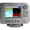
E62188-US - A57D 5.7 Combo, Coastal Maps, Int GPS
-
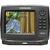
HDS-5 Multifunction Fishfinder/Chartplotter w/o Transdu 34246
-
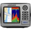
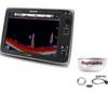
HDS-7 Gen2 Fishfinder GPS Chartplotter 53518700
-
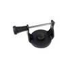
GPS receiver marine swivel mounting bracket
-
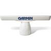
0100048400 Gmr404,Top Assembly,Antenna
-
Package(e127 with aus, NZ, S. America, Asia Chart, 4KW 18 Inch Digital Radome & Radar Cable)
-
Papr02 Region 2 Paper Chart Kit
-
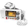
UM415 VHF Fixed Radio 38460
-
6ft 28AWG Dual Link DVI-D M/F Extension Cable - Black
-
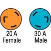
F3020ADSS Adapter,30A M to 20A F
-
CRC Marine Electronics Die-Lectic Grease 06106 (3.3 oz.)
-
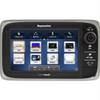
E62354 E7 7" Multifunction Display w/Internal GPS - No