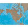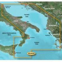
BlueChart g2 Vision - Adriatic Sea, South Coast - Maps
Model: Brand: Garmin
BlueChart g2 Vision offers the same rich detailed charting of BlueChart g2 to help you get the most out of your unit. In addition, g2 Vision features a growing database of high-resolution satellite imagery, above and below the water 3D perspective, auto guidance technology, aerial photographs for real world reference and coastal roads with points of interest. This product features detailed coverage of the Italian coast: from Porto Civitanova to extend south to Siracusa, Sicilia. From Split, Croatia to Killini, Greece « less
Product Specification
-
General
Product Type: MapsDistribution Media: SD Memory CardFirst Seen On Google Shopping: June 2007 -
Compatibility Information
Designed For: Garmin GPSMAP 4008, 4012, 420, 4208, 420s, 4212, 430, 430s, 430sx, 430x, 440, 440s, 440sx, 440x, 450, 5008, 5012, 520, 5208, 520s, 5212, 525, 525s, 530, 530s, 535, 535s, 540, 540s, 545, 545s, 550, 550s, 555, 555s -
Universal Product Identifiers
Part Numbers: 010-C0797-00, Adriatic Sea, South CoastGTIN: 00753759069773
Related Products
-
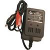
V-410 Automatic Ice Fishing Sonar Digital Charger
-
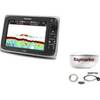
Package(e97 with aus, NZ, S. America, Asia Chart, 4KW 18 Inch Digital Radome & Radar Cable)
-
NAM033SD Mega Wide Atlantic CST & Carib
-
LED Stern Transom Mount Black ASL-335027
-
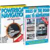
Video SNAV DVD Navigation Set W Powerboat
-
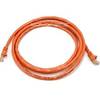
14ft 24AWG Cat6 500mhz Crossover Ethernet Bare Copper Network Cable - Orange
-
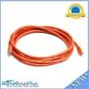
10ft 24AWG Cat6 550mhz UTP Ethernet Bare Copper Network Cable - Orange
-
70M Double Port Nav Light
-
Bulk cable - CAT 6 - Unshielded twisted pair (UTP) 1000 ft - White
-
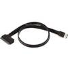
19inch Esatap to SATA 22pin Cable - Black
-
Micro Cable 1 Meter
-
Marine EC7E GPS-Chartplotter/Fish Finder with External Antenna, C-Map Max Card & 7" Color Display; NMEA Network Compatible - SI-TEX