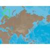
BlueChart g2 Vision - Bretagne - Maps
Model: Brand: Garmin
BlueChart g2 Vision offers the same rich detailed charting of BlueChart g2 to help you get the most out of your unit. In addition, g2 Vision features a growing database of high-resolution satellite imagery, above and below the water 3D perspective, auto guidance technology, aerial photographs for real world reference and coastal roads with points of interest. This product features detailed coverage from Saint-Vaast-la-Hougue to Le Croisic and Belle-Ile, including Cherbourg, the Channel Islands, Saint-Malo, Brest, and Lorient. « less
Product Specification
-
General
Product Type: MapsDistribution Media: SD Memory CardFirst Seen On Google Shopping: June 2007 -
Compatibility Information
Designed For: Garmin GPSMAP 4008, 4012, 420, 4208, 420s, 4212, 430, 430s, 430sx, 430x, 440, 440s, 440sx, 440x, 450, 5008, 5012, 520, 5208, 520s, 5212, 525, 525s, 530, 530s, 535, 535s, 540, 540s, 545, 545s, 550, 550s, 555, 555s -
Universal Product Identifiers
Part Numbers: 010-C0801-00, BretagneGTIN: 00753759069810
Related Products
-
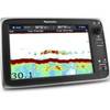
C127 Multifunction 12" Display with Sonar - aus, NZ, S. America, Asia Charts T70035 c44335
-
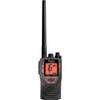
kv8715 Floating VHF Marine Radio
-
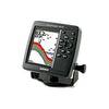
Fishfinder 340C - Fishfinder - included transducer - dual-beam
-
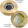
Magnifier Chart Weight, Brass
-
RS-C208 Furuno FP Format - Barents Sea West Fishing
-
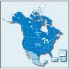
City Navigator North America NT 2012 Map Card Microsd/sd 010-11551-00 c38854
-
70 Allround Red Nav Light
-
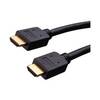
Vanco Installer Series High Speed - Video / audio / network cable - Male 19 pin HDMI Type A to M 19 pin HDMI Type A
-
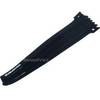
Hook & Loop Fastening Cable Ties 9inch, 10pcs/Pack - Black
-
Digital Mini UHF Male to Male Adapter DA-624
-
Cat6a Ethernet Cable | 2ft | Blue | Network | 10 Gigabit
-
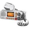
UM380 White VHF Radio Class D UM480