BlueChart g2 Vision - Hecate Strait South - Maps
Model: Brand: Garmin
BlueChart g2 Vision offers the same rich detailed charting of BlueChart g2 to help you get the most out of your unit. In addition, g2 Vision features a growing database of high-resolution satellite imagery, above and below the water 3D perspective, auto guidance technology, aerial photographs for real world reference and coastal roads with points of interest. This product features coverage of the southern portion of the Queen Charlotte Islands, Hecate Strait, Queen Charlotte Sound, and Queen Charlotte Strait. Includes detailed coverage of many areas including Port Hardy, BC, Burke Channel and Dean Channel. « less
Product Specification
-
General
Product Type: MapsDistribution Media: SD Memory CardFirst Seen On Google Shopping: May 2007 -
Compatibility Information
Designed For: Garmin GPSMAP 4008, 4012, 420, 4208, 420s, 4212, 430, 430s, 430sx, 430x, 440, 440s, 440sx, 440x, 450, 5008, 5012, 520, 5208, 520s, 5212, 525, 525s, 530, 530s, 535, 535s, 540, 540s, 545, 545s, 550, 550s, 555, 555s -
Universal Product Identifiers
Part Numbers: 010-C0695-00, Hecate Strait SouthGTIN: 00753759068752
Related Products
-
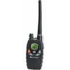
Marine Radio Nautico 1VP
-
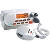
dq2954 25-Watt VHF Marine Class D DSC Mount Radio
-
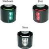
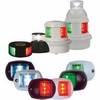
Series 43 White LED Navigation Light Port
-
Miscellaneous Problems in Maritime Navigation, Transport and Shipping: Marine Navigation and Safety of Sea Transportation [Book]
-
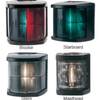
Marine Navigation Lights for Boats to 65'7" Starboard Series
-
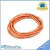
14ft 24AWG Cat5e 350MHz UTP Bare Copper Ethernet Network Cable - Orange
-
Series 32 LED Navigation Lights Black Housing, Masthead
-
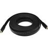
4163 30ft 24AWG CL2 Flat Standard HDMI Cable - Black
-
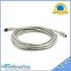
9 Pin/ 6pin Bilingual FireWire 800 - FireWire 400 Cable, 15ft, Clear
-
Cat6a Ethernet Cable | 5ft | White | Network | 10 Gigabit
-
63CM61 Male Plug for 50 AMP/125 Volt
-
Cat6a Ethernet Cable | 1ft | Yellow | Network | 10 Gigabit