BlueChart g2 Vision - North Slope Alaska - Maps
Model: Brand: Garmin
BlueChart g2 Vision offers the same rich detailed charting of BlueChart g2 to help you get the most out of your unit. In addition, g2 Vision features a growing database of high-resolution satellite imagery, above and below the water 3D perspective, auto guidance technology, aerial photographs for real world reference and coastal roads with points of interest. This product features detailed coverage of the northern coast of Alaska from Point Hope to the United States/Canadian border including Point Barrow, Kaktovik, and Peard Bay. « less
Product Specification
-
General
Product Type: MapsDistribution Media: SD Memory CardFirst Seen On Google Shopping: May 2007 -
Compatibility Information
Designed For: Garmin GPSMAP 4008, 4012, 420, 4208, 420s, 4212, 430, 430s, 430sx, 430x, 440, 440s, 440sx, 440x, 450, 5008, 5012, 520, 5208, 520s, 5212, 525, 525s, 530, 530s, 535, 535s, 540, 540s, 545, 545s, 550, 550s, 555, 555s -
Universal Product Identifiers
Part Numbers: 010-C0736-00, North Slope AlaskaGTIN: 00753759069162
Related Products
-
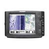
1100 Series 1197c SI Combo CHO - Marine Chartplotter - 10.4" color - 800 x 600
-
T70042 E95 Multifunction Display w/European Charts
-
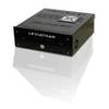
Marinenav Leviathan Marine Navigation PC Computer LEV-017-AMD
-
SAS-300 Class B AIS Transceiver w/ 6.5" Tft Disp
-
MOLEX to Dual 4-Pin Floppy Power Adapter Cable - MR1314
-
6ft 28AWG High Speed HDMI Cable w/Ferrite cores - Orange
-
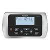
MWR150 Full Display Wired Marine Remote Control Map
-
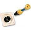
31910-1200 Quick Release Pressure Regulator W Adapter
-
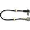
Dgada93m DA93M 3 Adapter Cable with
-
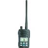
IC-M88 VHF 22-channel Two-way radio
-
7ft 24AWG Cat6 500mhz Crossover Ethernet Bare Copper Network Cable - Gray
-
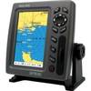
900 Series 997c SI Combo NVB - Marine Chartplotter - 8" color - 800 x 480 - widescreen