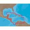
BlueChart g2 Vision - Southwest Florida - Maps
Model: Brand: Garmin
BlueChart g2 Vision offers the same rich detailed charting of BlueChart g2 to help you get the most out of your unit. In addition, g2 Vision features a growing database of high-resolution satellite imagery, above and below the water 3D perspective, auto guidance technology, aerial photographs for real world reference and coastal roads with points of interest. This product features crystal River through Key Largo, including Tampa Bay, Ft. Myers, Lake Okeechobee, Florida Bay, Key West, and the Dry Tortugas. « less
Product Specification
-
General
Product Type: MapsDistribution Media: SD Memory CardFirst Seen On Google Shopping: May 2007 -
Compatibility Information
Designed For: Garmin GPSMAP 4008, 4012, 420, 4208, 420s, 4212, 430, 430s, 430sx, 430x, 440, 440s, 440sx, 440x, 450, 5008, 5012, 520, 5208, 520s, 5212, 525, 525s, 530, 530s, 535, 535s, 540, 540s, 545, 545s, 550, 550s, 555, 555s -
Universal Product Identifiers
Part Numbers: 010-C0712-00, Southwest FloridaGTIN: 00753759068929
Related Products
-
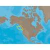
NA-C502 Furuno FP Format Western Caribbean S
-
NA-M025 Max Wide C Card Canada West
-
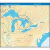
NT+ Wide Map, Mississippi and Illinois Rivers
-
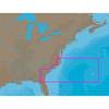
NA-C304 Furuno FP Format Norfolk Bermuda Jac
-
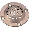
39161 Round Bronze Strainer, for Thru-Hull Size 1"
-
70 Starboard Nav Light
-
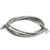
7ft 24AWG Cat5e 350MHz UTP Bare Copper Ethernet Network Cable - Gray
-
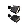
10 ft VGA cable 17 pin analog DVI - male - 15 pin HD D-Sub (HD-15) - male - PC
-
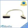
743 HPDB50 M/CN50 M SCSI Cable , 25pr - 1.5ft
-
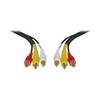
Video / audio cable - Male RCA phono x 3 to F RCA phono x 3
-
Marine EC11 GPS-Chartplotter/Fish Finder with External Antenna, C-Map Max Card & 10.4" Color Display; NMEA Network Compatible - SI-TEX
-
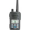
IC-M88-IS Intrinsically Safe Handheld VHF Marine Radio