BlueChart g2 Vision - Wrangell to Dixon Entrance - Maps
Model: Brand: Garmin
BlueChart g2 Vision offers the same rich detailed charting of BlueChart g2 to help you get the most out of your unit. In addition, g2 Vision features a growing database of high-resolution satellite imagery, above and below the water 3D perspective, auto guidance technology, aerial photographs for real world reference and coastal roads with points of interest. This product features detailed coverage from Cape Ommaney to Prince Rupert including Prince of Wales Island, Dixon Entrance, Wrangell, AK, Behm Canal, and Observatory Inlet. « less
Product Specification
-
General
Product Type: MapsDistribution Media: SD Memory CardFirst Seen On Google Shopping: May 2007 -
Compatibility Information
Designed For: Garmin GPSMAP 4008, 4012, 420, 4208, 420s, 4212, 430, 430s, 430sx, 430x, 440, 440s, 440sx, 440x, 450, 5008, 5012, 520, 5208, 520s, 5212, 525, 525s, 530, 530s, 535, 535s, 540, 540s, 545, 545s, 550, 550s, 555, 555s -
Universal Product Identifiers
Part Numbers: 010-C0725-00, Wrangell to Dixon EntranceGTIN: 00753759069056
Related Products
-
346c Di Color Sonar
-
The Nautical Chart Movie Photo Print (11 x 17)
-
Ocean Chart Lamp, Medium
-
Max AN-M202 W50 Korea Strait, Okinawa Shima-MAX
-
Embassy Cruising Guides - Chesapeake Bay to Florida #BKCBF-02
-
Series 22 Navigation Lights Deck Mount, Red, 1/4" x 1/8"
-
7ft 24AWG Cat5e 350MHz UTP Bare Copper Ethernet Network Cable - Green
-
Fiber Optic Cable, LC/LC, Multi Mode, Duplex - 15 Meter 4834
-
TM260-8F 1kW 50/200 kHz Transom Mount Transducer 8F Connector
-
14ft 24AWG Cat5e 350MHz UTP Ethernet Bare Copper Network 139
-
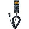
HM-162 Command Mic
-
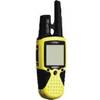
RINO 110 - Hiking GPS receiver / two-way radio - Monochrome - 160 x 160