Chapman Nautical Chart No. 1: The Essential Guide to Chart Reading and Navigation [Book]
The essential reference tool for reading maps, published by the Coast Guard, is now available to boaters in an attractive, colorful edition that includes important supplementary information about navigation. A must-have for all mariners, the first half of the manual reproduces the U.S. Coast Guard book, with coverage of basic chart concepts, the anatomy of a chart, how to read a chart, symbols and abbreviations associated with National Ocean Service and Defense Mapping Agency charts, and the chart numbering system. In addition, for extra value, the USCG version has been expanded to include navigation tips and techniques from Chapman Piloting and Seamanship, 64th edition, including details on positioning procedures, dead reckoning, and river piloting. « less
Product Specification
-
Authors: John Wooldridge, John Wooldridge United States Coast Guard United States Coast GuardPages: 201Format: paperbackPublication Date: October 1, 2004Key Terms: daybeacons, Notices to Mariners, nautical charts, nautical miles, racon, IALA, Light Lists, compass rose, Radar, statute miles, U.S. Coast Guard, Morse Code, trom, chart datum, Loran-C, Anchorage, World Geodetic System, GEOGRAPHIC COORDINATES, Degaussing, Cape Hatteras
-
Universal Product Identifiers
ISBN: 1588164004GTIN: 09781588164001
Related Products
-
IR2 4D 4KW 25" Dome Radar R-0003
-
A29 Imray Dominica Marine Nautical Chart
-
NA-M025 Max Wide C Card Canada West
-
2272 Rapid Ditch Bag
-
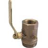
Inline Valve, 1 Inch Pipe
-
Practical Marine Navigation [Book]
-
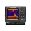
HDS 5x Gen2 - Fishfinder
-
30ft 24AWG Cat6 550mhz UTP Ethernet Bare Copper Network Cable - Yellow
-
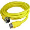
30 Amp 35' Cord Set - Yellow - 125V
-
3ft 28AWG High Speed HDMI Cable w/Ferrite cores - White
-
100ft 24AWG Cat6 550mhz UTP Ethernet Bare Copper Network Cable - Gray
-
SS264W - 50kHz - 20 Deg - 10 Pin Furuno Connector