Chart No. 1 Nautical Chart Symbols Abbreviations and Terms [Book]
Chart No. 1 contains a description of the symbols, abbreviations and terms that appear on nautical charts produced by the National Imagery and Mapping Agency, the National Ocean Service and the International Hydrographic Organization.
Product Specification
-
Authors: Griffes, NIMAFormat: paperbackPublication Date: January 1, 2000Key Terms: Plane of Reference, Sector lights, Traffic separation scheme, chart datum, buoy, nautical miles, Racon, Anchorage, Degaussing, nautical charts, World Geodetic System, Fish haven, WHlS, Ash Volcanic, Dot Lt, Supplementary national symbols, Cable Ferry, Loran-C, Submarine power cable, Topmark
-
Universal Product Identifiers
ISBN: 1577852753GTIN: 09781577852759
Related Products
-
E22166 P70 Autopilot Control Head
-
Commander P2 Mono Display, SSRC1 Rate Gyro Compass & Linear Feedback 10110032
-
010-10800-72 Bluechart G2 Map Update
-
300 Series 323 - Fishfinder - included transducer : XNT-9-20-T - dual-beam
-
010-C0738-10 Bluechart G2 HUS400SWalkers Cay to Exuma Sound
-
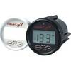
DF1000D Digital Depth Finder
-
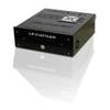
Marinenav Leviathan Marine Navigation PC Computer LEV-017R-Intel
-
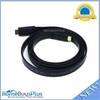
6ft 24AWG CL2 Flat High Speed HDMI Cable - Black
-
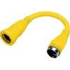
HBL61CM71 Adapter 30A Female to 50A 250V Male
-
Terminal, Feed Thru 3/8 Small Red
-
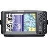
900 Series 997c SI Combo NVB - Marine Chartplotter - 8" color - 800 x 480 - widescreen
-
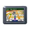
n�vi 275T - Automotive GPS receiver - 3.5" color - 320 x 240