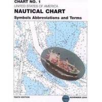
Chart No. 1 Nautical Chart Symbols Abbreviations and Terms: Spiral-Bound [Book]
Chart No. 1 contains a description of the symbols, abbreviations and terms that appear on nautical charts produced by the National Imagery and Mapping Agency, the National Ocean Service and the International Hydrographic Organization.
Product Specification
-
Authors: Griffes, NIMAFormat: bookPublication Date: January 1, 2000
-
Universal Product Identifiers
ISBN: 1577852761GTIN: 09781577852766
Related Products
-
BlueChart g2 Vision - Lake Huron - Lake St. Clair - Maps
-
Vancouver Harbour,Eastern Portion Indian Arm Chart
-
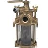
Flushing Strainer, 1 1/4 Inch
-
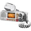
gb0533 Full-featured Fixed Mount VHF Marine Radio-white
-
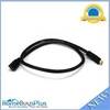
3ft 24AWG CL2 High Speed HDMI Cable Male to Female Extension - Black
-
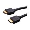
Vanco Installer Series High Speed - Video / audio / network cable - Male 19 pin HDMI Type A to M 19 pin HDMI Type A
-
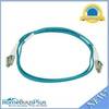
10gb Fiber Optic Cable, LC/LC, Multi Mode, Duplex - 1 Meter
-
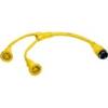
HBL64CM57 Y Adapter 2 30A Cords - 50A 125V Dock
-
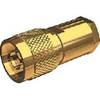
Nm8x-g Male N Connector for RG-8X Cable
-
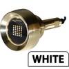
B60-12 Tiled Element Ducer W/10P Pigtail Connector
-
Lumishore THX72-B Thru-Hull Underwater Light - Blue 72w
-
GPSMAP 526s - Marine Chartplotter - 5" color - 480 x 640