Chartwork and marine navigation for fishermen and boat operators [Book]
Product Specification
-
Authors: Geoff A. Motte, Thomas M. StoutPages: 173Format: paperbackPublication Date: 1984.07Key Terms: parallel sailing, Loran, celestial sphere, position line, celestial pole, plane sailing, nautical miles, Chart Datum, set and drift, Nautical Almanac, Pole Star, position circle, parallax, rhumb line, meridian altitude, Vineyard Sound, zenith distance, prime meridian, azimuth, intercept method
-
Universal Product Identifiers
ISBN: 0870333143GTIN: 09780870333149
Related Products
-
MapSource BlueChart - New York - New Jersey - Maps
-
PC Planner F Max Charts W O Memory Card
-
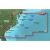
BlueChart g2 Vision - Mid-Atlantic - Maps
-
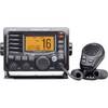
M504 Black VHF Radio with Hailer M504A 61
-
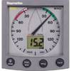
ST60 Plus Wind System, Wind System with Display, St 60 Ray Marine
-
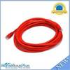
14ft 24AWG Cat6 550mhz UTP Ethernet Bare Copper Network Cable - Red
-
Cat6a Ethernet Cable | 10ft | Red | Network | 10 Gigabit
-
Navigation Light [Book]
-
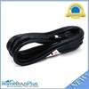
Shore Power Cable 6/4 White Per ft
-
15ft 14AWG Power Cord Cable w/ 3 Conductor PC Power Connector Socket (C13/5-15P) - Black
-
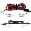
MARE-003 - Adapter, Yamaha Cmnd Link to Micro Male
-
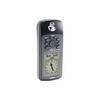
GPS 72 - Marine, hiking GPS receiver - Monochrome - 120 x 160