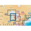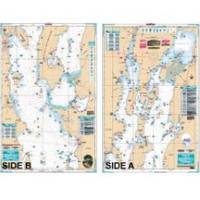
Lake Champlain Fishing North - Waterproof Charts
Designed for recreational boaters, fishermen and divers. Waterproof Charts are beautifully printed on synthetic paper. For use on deck in any weather rain or spray! Accurate, used by Coast Guard and Navy, simple to use with GPS. Foldable and easy to hold and store Waterproof Charts are so tear resistant you can't ruin them. Printed on both sides so they save you money! All Charts are 25"x38" This LARGE PRINT Lake Chart details all of the Major Fishing Areas and pinpoints dozens of specific areas for the major species caught in the area. (Large and Smallmouth Bass, Yellow Perch, Walleye, Muskie, Northern Pike, Salmon & Trout). Many areas have GPS positions. Grass and Marsh areas are also identified. Marinas are listed as well as popular Boat Ramps. Starting at Willsboro and Shelburne Points coverage is north to and including Missisquoi Bay and the Rt 202 Bridge on the Richelieu River in Canada. Includes Malletts Bay and all of the Champlain Islands. Information from 2 NOAA Charts: 14782 & 14781. This Chart is 25" X 38" and folded to 7"X14" « less
Product Specification
-
Universal Product Identifiers
Part Number: 12F
Related Products
-
32610 SE-200C Sonar engine
-
CH250BB/88/340 88 kHz Black Box Searchlight Sonar System. Includes 400mm Travel Hoist and Operates at 24 & 32VDC
-
MSD/646P+ Platinum Plus Lake Michigan on SD/MicroSD
-
Max EN-M019 MW4 North and Baltic Seas-MAX
-
2682 AIS Transceiver with Cables Software No Antennas
-
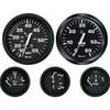
KT9796 Euro 4-Gauge Set (Speed Tach Fuel Volt)
-
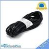
15ft 18AWG Power Cord Cable w/ 3 Conductor PC Power Connector Socket (C13/5-15P) - Black
-
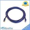
10ft 24AWG Cat6 550mhz UTP Ethernet Bare Copper Network Cable - Purple
-
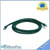
7ft 24AWG Cat6 550mhz UTP Ethernet Bare Copper Network Cable - Green
-
93-SMTY50W-A Smart Y Adapter - 1 50A 125/250VAC Connect
-
lian M2-TD02 I-Series Dish Network Multi-Satellite Interface Mult
-
GPSMAP 431s - Marine GPS receiver - 4" color - 240 x 320