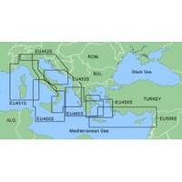
MapSource BlueChart - Adriatic Sea, South Coast - Maps
Model: Brand: Garmin
MapSource BlueChart is Garmin's exclusive marine cartography and was developed to provide you with mapping flexibility and options you've never had before. This line of cartography products is designed to provide interactive viewing of detailed nautical chart data, thereby providing navigators with innovative object-oriented cartography. These detailed electronic nautical charts look just like paper charts when displayed on your Garmin chartplotter. Features include shading between depth contours, spot soundings, navaids, port plans, wrecks, obstructions, inter-tidal zones, and more. BlueChart offers much larger coverage areas for half the price. MapSource BlueChart Adriatic Sea, South Coast provides detailed coverage of Italian coast from Porto Civitanova to extend south to Siracusa, Sicilia. From Split, Croatia to Killini, Greece. « less
Product Specification
-
General
Product Type: MapsDistribution Media: microSD Memory CardFirst Seen On Google Shopping: January 2006 -
Compatibility Information
Designed For: Garmin eTrex Legend Cx, Vista Cx Garmin GPSMAP 60CSx, 60Cx, 76CSx, 76Cx -
Universal Product Identifiers
Part Numbers: 010-C0440-00, Adriatic Sea, South Coast
Related Products
-
1440 Handi-Mate O.B. Handle
-
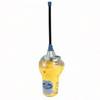
MCzmuro Smartfind Plus GPS 406 EPIRB Category 1 29954
-
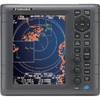
1835 4KW 24" Dome 10. 4" Color LCD Radar
-
Package(c127 with USA Coastal Chart, 4KW 24 Inch Digital Radome & Radar Cable)
-
Marine 004532161 Xenon Chart Light with 19" Flexible Arm, Black
-
2875 Satellite 3 406 Cat II EPIRB
-
Bulk cable - Fiber optic 1000 ft
-
6ft 24AWG CL2 Flat High Speed HDMI Cable - Black
-
Marine Antennas - Cellular phone antenna - Marine
-
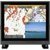
MU190HD 19 Inch Color LCD Marine Monitor
-
329900-1 UHF Connector Male F/8U Cable
-
FCF009000GS 9000 BTU FCF Reverse Cycle Air Conditioning Unit