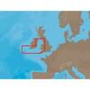
MapSource BlueChart - Aegean Sea and Sea of Marmara - Maps
Model: Brand: Garmin
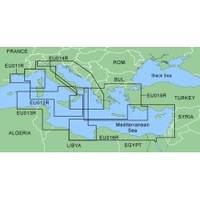
MapSource BlueChart is Garmin's exclusive marine cartography and was developed to provide you with mapping flexibility and options you've never had before. This line of cartography products is designed to provide interactive viewing of detailed nautical chart data, thereby providing navigators with innovative object-oriented cartography. These detailed electronic nautical charts look just like paper charts when displayed on your Garmin chartplotter. Features include shading between depth contours, spot soundings, navaids, port plans, wrecks, obstructions, inter-tidal zones, and more. BlueChart offers much larger coverage areas for half the price. MapSource BlueChart Aegean Sea and Sea of Marmara includes all of the Greek coast and Aegean Sea; Turkey from Istanbul and Sea of Marmara to Antalya; and Brindisi, Italy. « less
Product Specification
-
General
Product Type: MapsDistribution Media: microSD Memory CardFirst Seen On Google Shopping: January 2006 -
Compatibility Information
Designed For: Garmin eTrex Legend Cx, Vista Cx Garmin GPSMAP 60CSx, 60Cx, 76CSx, 76Cx -
Universal Product Identifiers
Part Numbers: 010-C0390-00, Aegean Sea and Sea of MarmaraGTIN: 00753759056193
Related Products
-
Baynes Sound Chart
-
EW-C207 Furuno FP Format - Bristol Channel & Irish Sea
-
12 in. Plain Brass Fog Bell
-
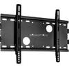
Low Profile Wall Mount Bracket for LCD LED Plasma (Max 165Lbs, 23~37inch) - Black
-
Practical Marine Navigation [Book]
-
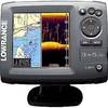
Elite-5 DSi Gold Color DownScan Combo Unit
-
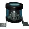
Orca Green Marine LED Masthead / Anchor Navigation Light 9385337
-
HBL61CM52 - Marine Cord Set, Shore Power, 50ft, 50A
-
560 VGA + 3.5mm Stereo Audio Male to Male Cable 50 ft. CL2
-
20110003 SP-36 Second Station Kit W/25' Cable
-
da-da572 Mini-UHF Male to TNC Female Adapter
-
Goal Zero - Yeti 1250 1500w/1200w Portable Solar Generator 31901