MapSource BlueChart - Irish Sea - Maps
Model: Brand: Garmin
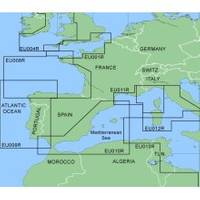
MapSource BlueChart is Garmin's exclusive marine cartography and was developed to provide you with mapping flexibility and options you've never had before. This line of cartography products is designed to provide interactive viewing of detailed nautical chart data, thereby providing navigators with innovative object-oriented cartography. These detailed electronic nautical charts look just like paper charts when displayed on your Garmin chartplotter. Features include shading between depth contours, spot soundings, navaids, port plans, wrecks, obstructions, inter-tidal zones, and more. BlueChart offers much larger coverage areas for half the price. MapSource BlueChart Irish Sea covers British coast from Port Ellen on the Isle of Islay to Falmouth, including the Isle of Man and the Isles of Scilly; Irish coast from Sheep Haven to Caherciveen, Republic of Ireland, including Londonderry, The Storks, Belfast, and Dublin. « less
Product Specification
-
General
Product Type: MapsDistribution Media: Garmin Data CardFirst Seen On Google Shopping: January 2006 -
Compatibility Information
Designed For: Garmin GPSMap 172C, 176, 176C, 178C, 178C Sounder, 182, 182C, 188 Sounder, 188C Sounder, 196, 2006, 2006C, 2010, 2010C, 2106C, 2110C, 2206C, 2210C, 232, 238 Sounder, 276C, 292C, 296, 298C, 3006C, 3010c, 3205C, 3206C, 3210C, 376C, 392C, 396C, 492C, 498C -
Universal Product Identifiers
Part Numbers: 010-C0073-00, Irish Sea
Related Products
-
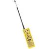
2726A 2-Channel VHF GMDSS Survival Craft Radio
-
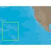
NA-C603 Furuno FP Format Hawaiian Islands
-
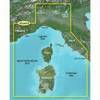
BlueChart g2 Vision - Ligurian Sea, Corsica and Sardinia - Maps
-
Cat6a Ethernet Cable | 3ft | Orange | Network | 10 Gigabit
-
dq2954 25-Watt VHF Marine Class D DSC Mount Radio
-
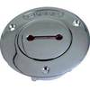
Deck Plates, Fills for Pipe, 2-1/2", Unmarked, Bronze
-
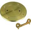
0526003PLB 3" Bronze Deck Plate
-
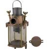
049300799C Transparent Cylinder F/0493007Plb
-
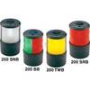
Navigation Light Sern #0200SNTDP1
-
SS264W - 50kHz - 12 Deg - 6 Pin Garmin Connector
-
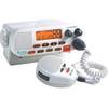
VHF255Sw White VHF Radio
-
CPV550 Large-Screen GPS Chartplotter and VHF Radio