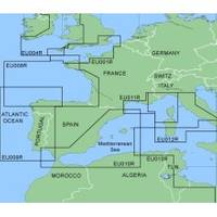
MapSource BlueChart - Irish Sea - Maps
Model: Brand: Garmin
MapSource BlueChart is Garmin's exclusive marine cartography and was developed to provide you with mapping flexibility and options you've never had before. This line of cartography products is designed to provide interactive viewing of detailed nautical chart data, thereby providing navigators with innovative object-oriented cartography. These detailed electronic nautical charts look just like paper charts when displayed on your Garmin chartplotter. Features include shading between depth contours, spot soundings, navaids, port plans, wrecks, obstructions, inter-tidal zones, and more. BlueChart offers much larger coverage areas for half the price. MapSource BlueChart Irish Sea covers British coast from Port Ellen on the Isle of Islay to Falmouth, including the Isle of Man and the Isles of Scilly; Irish coast from Sheep Haven to Caherciveen, Republic of Ireland, including Londonderry, The Storks, Belfast, and Dublin. « less
Product Specification
-
General
Product Type: MapsDistribution Media: microSD Memory CardFirst Seen On Google Shopping: January 2006 -
Compatibility Information
Designed For: Garmin eTrex Legend Cx, Vista Cx Garmin GPSMAP 60CSx, 60Cx, 76CSx, 76Cx -
Universal Product Identifiers
Part Numbers: 010-C0312-00, Irish Sea
Related Products
-
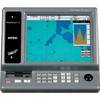
TRAWLPLOT 12 SD Color Chartplotter w/WAAS Receiver
-
XN12A/4 4' Open Array Antenna
-
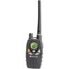
Nautico 1 VHF 88-channel Two-way radio
-
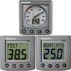
T22072-P - ST60+ System Pack (Depth, Speed & Wind)
-
Cat6a Ethernet Cable | 7ft | Black | Network | 10 Gigabit
-
10ft 24AWG CL2 High Speed HDMI Cable w/ Net Jacket - Black
-
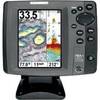
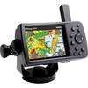
700 Series 787c2i Combo - Marine Chartplotter - 5" color - 640 x 480
-
3ft 32AWG Mini DisplayPort to DVI Cable - White
-
Connector Kit for 3/8 Inch LED Rope Light - Imt-ilmdl-conkit-l6
-
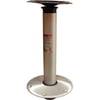
Hi-Lo 9" Fixed Height 2-3/8 Plug-in Pedestal Set - Springfield Marine
-
2ft 24AWG Cat6 550mhz UTP Ethernet Bare Copper Network Cable - Gray
-
GPSMAP 376C - Marine GPS receiver - 3.8" color - 480 x 320