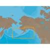
Max Mega Wide International cmegai
Model: Brand: C-Map
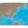
Dynamic tides and currents predict the time, level, direction and strength of currents and tides. Guardian Alarm performs an automatic forward-scanning check for obstacles. Use this feature as an added backup to alert you if you head toward a potentially harmful object. Photos and diagrams in high-definition of ports, marinas and significant navigational marks will help you to familiarize yourself with new destinations and passages. Route-check is an extension of Guardian Alarm, helping keep you safe by indicating obstacles along the segments between waypoints. Depths and land elevation show the usual depth information and the colors make it easy to distinguish different water depths and land elevations. Detailed harbor charts so docking in unfamiliar ports is no problem. You have precise layouts of thousands of marinas, including slip spaces, restricted areas and other valuable navigation information. Perspective view gives a bird's-eye view of your navigation area, it tilts the chart view to a 45-degree angle. C-Marina Port Database has details on more marinas than other charts on the market. Multi-language capability All C-MAP by Jeppesen charts can be displayed in both English and the local language of each region. « less
Product Specification
-
Universal Product Identifiers
Part Number: cmegai
Related Products
-
North River Type Rowlock Horns *Pr*
-
Colormax Pro LCD C-Map MAX/NT+ Charting System
-
Magnifier Chart Weight, Brass
-
NA-C802 Furuno FP Format Gulf of Alaska
-
AN-M203 C-Card Format Yellow Sea & Malaya
-
010-C0796-10 Bluechart G2 HEU452SAdriatic Sea North Coast
-
WPC034 Sandy Hook NJ to AC NJ Ed 3
-
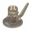
Seacock Body, 3/4 Inch Pipe Size 0805005PLB
-
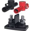
Power Post Dual 2 x 5/16 in. Studs
-
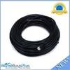
75ft 24AWG Cat6 550mhz UTP Ethernet Bare Copper Network 5026
-
FCF5000 Kit with AC, Seawater & Ducting - 115V FCFK016A c44588
-
Smartfind Plus G5 GPS EPIRB Cat I 29953