Max Wide International cwidei
Model: Brand: C-Map
C-map Max Compatible Plotters List Please Select a Chart Number from the Picture Below and Type in the Chart Number in the Box Next to Shopping Cart Features Dynamic NavAids include detailed information on navigational aids, including name, color, information on frequency, range of the light, etc. Dynamic tides and currents predict the time, level, direction and strength of currents and tides. Guardian Alarm performs an automatic forward-scanning check for obstacles. Use this feature as an added backup to alert you if you head toward a potentially harmful object. Photos and diagrams in high-definition of ports, marinas and significant navigational marks will help you to familiarize yourself with new destinations and passages. Route-check is an extension of Guardian Alarm, helping keep you safe by indicating obstacles along the segments between waypoints. Depths and land elevation show the usual depth information and the colors make it easy to distinguish different water depths and land elevations. Detailed harbor charts so docking in unfamiliar ports is no problem. You have precise layouts of thousands of marinas, including slip spaces, restricted areas and other valuable navigation information. Perspective view gives a bird's-eye view of your navigation area, it tilts the chart view to a 45-degree angle. C-Marina Port Database has details on more marinas than other charts on the market. Multi-language capability All C-MAP by Jeppesen charts can be displayed in both English and the local language of each region. More than 140 languages are available Australia & New Zealand & Oceania Number Code Coverage W60 M-AU-M005 AUSTRALIA W61 M-AU-M207 PAPUA NEW GUINEA W63 M-AU-M222 NEW ZEALAND, CHATHAM I. « less
Product Specification
-
Universal Product Identifiers
Part Number: cwidei
Related Products
-
AP2804VRF Autopilot AP28,AC42,RC42,RPU160
-
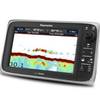
E97 Multifunction 9" Display with Sonar - aus, NZ, S. America, Asia Charts T70045 c44345
-
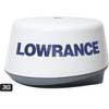
3G Broadband Radar Dome with 10 Meter Cable for HDS models 000-10418-001 c41760
-
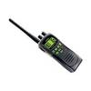
ATLANTIS 250 VHF Two-way radio
-
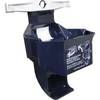
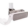
9502 Low Pro 3 Cat II EPIRB Mounting Bracket
-
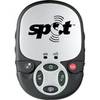
Spot 2 Satellite GPS Messenger - Silver Gloss Silver
-
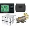
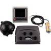
100070500 GHP 10 Marine Autopilot System
-
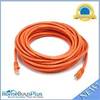
30ft 24AWG Cat6 550mhz UTP Ethernet Bare Copper Network Cable - Orange
-
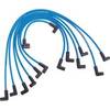
Marine Products Plug Wire Set, Mercruiser V-8, 9-28000
-
Floodlight Kit for 1- Diameter Light Bars - Includes LED Light & Hardware PM-114LT-LED
-
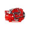
14.0 Sbeg Generator
-
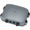
DSM30 Digital Network Sounder Module E63074