NA-C705 Furuno FP Format Banks Is BC Sumner Strait AK
Model: NA-C705 Brand: C-Map
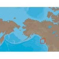
With are Electronic Sharts C-Maps we have: Olympia, Washington to Port Mcneill, British Columbia. Nannose to Victoria to Cape Scott Texada Island to Caamano Sound Cape Caution to Portland Canal Banks Island, British Columbia to Sumner Strait, Alaska Dixon Entrance to Icy Bay Gulf of Alaska Western Alaska NA-C705 Banks Island, BC To Sumner Strait, Alaska NT+ Cartography NT+ electronic charts feature much wider coverage areas at substantially lower prices. « less
Product Specification
-
Universal Product Identifiers
Part Numbers: 20183, NA-C705FURUNOFP
Related Products
-
X67-C Sonar [DVD]
-
Mark 5x - Fishfinder - included transducer : Skimmer
-
MSD/DWL-S Marine & Lakes USA
-
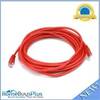
20ft 24AWG Cat5e 350MHz UTP Bare Copper Ethernet Network Cable - Red
-
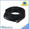
75ft 24AWG Cat5e 350MHz UTP Bare Copper Ethernet Network Cable - Black
-
Marine Products Plug Wire Set 9-28049
-
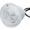
Flush Mount Utility Light 401510-1 Threaded Mount 25-1527
-
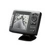
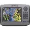
HDS-7m - Marine Chartplotter - 6.4" color - 640 x 480
-
Whisper 60 Inch Galvanized Augers Set of Four Earth Anchors
-
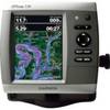
GPSMAP 536 - Marine Chartplotter - 5" color - 480 x 640
-
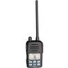
VHF Handheld Radio Black (151-ICM88)
-
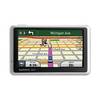
n�vi 1300LMT - Hiking, automotive GPS receiver - 4.3" color - 480 x 272 - widescreen