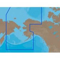
NA-C804 Furuno FP Format Northern Alaska
Model: NA-C804 Brand: C-Map
With are Electronic Sharts C-Maps we have: Olympia, Washington to Port Mcneill, British Columbia. Nannose to Victoria to Cape Scott Texada Island to Caamano Sound Cape Caution to Portland Canal Banks Island, British Columbia to Sumner Strait, Alaska Dixon Entrance to Icy Bay Gulf of Alaska Western Alaska NA-C804 Western Alaska NT+ Cartography NT+ electronic charts feature much wider coverage areas at substantially lower prices. « less
Product Specification
-
Universal Product Identifiers
Part Numbers: 20186, NA-C804FURUNOFP
Related Products
-
SP-80R Autopilot with 30 in. cu. Pump & Rotary Feedback csp80rl
-
10' Network Cable for Scp Remote Panel 809-0938
-
GP-150D GPS Navigator w/Differential
-
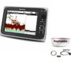
T70025 C97 Multifunction Display w/Sonar - Row Charts
-
GSM2000 2KW Sonar Module 50/200kHz Side Imaging 40355
-
000-10421-001 Broadband 4G Radar w/20m Cable
-
Package(c97 with aus, NZ, S. America, Asia Chart, 4KW 18 Inch Digital Radome & Radar Cable)
-
010-C0795-10 Bluechart G2 HEU451SLigurian Sea Corsica
-
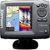
Elite 5 Gold Combo Fishfinder/Chartplotter
-
6ft Premier Series XLR Male to XLR Female 16AWG Cable (Gold Plated) [Microphone & Interconnect]
-
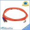
Fiber Optic Cable, LC/ST, Multi Mode, Duplex - 3 Meter 2623
-
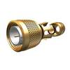
N-Type-Cp/Cs-01 Connector for Rg-58Au Cable