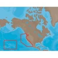
NA-M024 SD Card Format US West Coast and Haw
Model: NA-M024 Brand: C-Map
NA-M024 => USA West Coast and HawaiiCoverage of the Pacific Coast of the United States, including all of the coasts of California, Oregon and Washington. Coverage of Baja California and Mexico down to Puerto Vallarta. Detail of the Columbia River, Sacramento River, Willamette River. Snake River and San Joaquin Rivers are also included. Full coverage of Puget Sound and the San Juan Islands up to Point Roberts is also included. Additional coverage of the Hawaiian Islands out to Midway and Johnston Atoll is also included. « less
Product Specification
-
Universal Product Identifiers
Part Numbers: 30147, CMANAM024SD, M-NA-M024, NA-M024-SD, NA-M024SDCARDGTIN: 000000165847, 00686074002746
Related Products
-
AP35-22 Autopilot with AP35, Rudder Feedback RF300, J300X and RPU-300 24V Drive Unit (for Hydraulic Steering) sap3522
-
Onix350 HH GPS w/ Georeferenced Satellite Photos
-
A67 Mfd Touchscreen W/built-in Digital Sonar - Navioni Map
-
CH250BB/60/240 60 kHz Black Box Searchlight Sonar System. Includes 400mm Travel Hoist and Operates at 12VDC
-
A27 Imray Antigua Marine Nautical Chart
-
M504 Gray VHF Radio with Hailer
-
Hydrostatic Release Kit - 9490
-
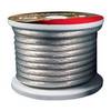
Raptor - BC4S100 - 4-Gauge Battery Cable - Silver 100' Spool
-
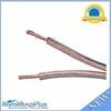
300ft 12AWG Enhanced Loud Oxygen-Free Copper Speaker Wire Cable
-
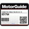
CONNECTOR, Female Tab 16-14 x .187 25 Per Package
-
2018BP-24 24V Black T-Motor Plug
-
M8A5000-32DN Micro Field-Attachable Connector (Female)