Nautical Charts [Book]
This historic book may have numerous typos and missing text. Purchasers can download a free scanned copy of the original book (without typos) from the publisher. Not indexed. Not illustrated. 1908 edition. Excerpt: ...the 2, 4, 6, 10, and 20 meter and various deeper curves, and the French the 2, 5, 10, and 20 meter and deeper curves. On the United States Lake Survey charts the areas included within the 6, 12, and 18 foot curves are shaded with a blue tint, heavy along the outer edge, which brings out strongly the shoal areas. Depth curves if clearly shown are a great aid in interpreting the hydrography and making plain the shoals and passages. The system of curves should always be understood when using a chart, and it may sometimes aid the navigator to trace out with a pencil an additional curve, if needed, beyond the draft of his vessel. The abbreviations used for the bottom characteristics are explained either on the chart or on the sheet of chart symbols, and give information which is useful in anchoring, and may be helpful in identifying a position by soundings. When a sounding is made without the lead reaching bottom, the depth obtained is sometimes shown on the chart by a short line and zero above the figure, indicating that at the depth stated, bottom was not obtained (no bottom). There are a few important symbols shown in the water area of charts. The sunken rock symbol indicates a dangerous area, or a danger having a moderate depth of water over it, or a rock the least water over which is not known; ordinarily on the United States charts the least depth will be stated when known, and the symbol omitted. The rock awash symbol indicates a rock awash at some stage of the tide, unless more definitely stated. The position of a wreck is indicated by a special symbol. P. D. (position doubtful) and E. D. (existence doubtful) are placed after soundings or rocks or other features which depend on some doubtful report not yet verified. The following are the... « less
Product Specification
-
Authors: George Rockwell PutnamPages: 64Format: paperbackPublication Date: 2012.06
-
Universal Product Identifiers
ISBN: 0217433995GTIN: 09780217433990
Related Products
-
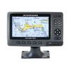
15342 Chart Master 169CS Wide Screen Chart Plotter
-
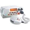
MRF45 VHF Two-way radio
-
Hydrographical Surveying. a Description of the Means and Methods Employed in Constructing Marine Charts. [Book]
-
9426a 17 Cable Harness F RCL-75
-
Smartpilot SPX-5R Sport Autopilot - E12220
-
Marine Naviled 360 All-Round Navigation Light
-
5500 Series LED All Around Navigation Lights 60" Straight Pole
-
Navigation Light BAY15d Replacement Bulb 9353392
-
2018 Dual PowerPost Cable Connectors
-
Light bracket, LTB-R
-
lian B3-I3DN i3 System Dish Network All-in-One Package w/Multi-Sa
-
GlobalMap 5300C iGPS - Marine GPS receiver - 5" color - 480 x 480