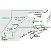
NT+ - St. Lawrence River and Approaches NA-C202
Model: NA-C202 Brand: C-Map
C-MAP has set the standard for electronic charts with five consecutive NMEA awards for "Best Electronic Cartography". The spring 2004 C-MAP NT+ release will include marina detail for over 1,000 US marinas in C-MAPs private collection. Now you will be able to see slip detail as well as the locations for onshore facilities. Finding the right chart plotter for you is easy with 17 manufacturers powered by C-MAP. Just look for the NT+ logo. « less
Product Specification
-
Universal Product Identifiers
Part Number: NA-C202GTIN: 00686074003781
Related Products
-
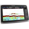
T70037 C127 Multifunction Display W Sonar - US Inland Chart
-
CH270BB/212 180 kHz Black Box Searchlight Sonar System. Includes 250mm Travel Hoist and Operates at 12VDC
-
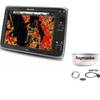
Package(e125 with aus, NZ, S. America, Asia Chart, 4KW 24 Inch Digital Radome & Radar Cable)
-
2798.91 FBRS 2798 Battery Replacement Service
-
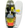
MT-403FF AccuSat 406 Cat 1 EPIRB Non-Hazmat Withbracket
-
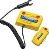
Autotether 100-A-01 Wireless Lanyard
-
Series 50 Classic Stainless Steel Navigation Lights
-
70M Double Starboard Nav Light
-
1.5ft Premier Series XLR Female to 1/4inch TRS Male 16AWG
-
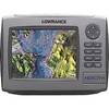
HDS-7m - Marine Chartplotter - 6.4" color - 640 x 480
-
Cat6a Ethernet Cable | 75ft | White | Network | 10 Gigabit
-
GPSMAP 740 - Marine Chartplotter - 7" color - 800 x 480 - widescreen