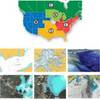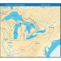
NT+ Wide Map, Mississippi and Illinois Rivers
Model: Brand: C-Map
C-MAP has set the standard for electronic charts with five consecutive NMEA awards for "Best Electronic Cartography". Built on the incredible success of C-MAP NT+, NT+ Wide combines a generation of chartplotters with efficient performance plus real-time accuracy and detail. Now you will be able to see slip detail as well as the locations for onshore facilities. « less
Product Specification
-
Universal Product Identifiers
Part Number: NA-C040GTIN: 00686074004016
Related Products
-
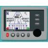
Commander Color Display with SSRC1 Rate Gyro Compass & Rotary Feedback 10110034
-
37637 HotMaps Platinum Multi-Dimensional 3D Lake Maps
-
Low Profile Wall Mount Bracket for LCD LED Plasma (Max 165Lbs, 23~37inch) - Silver
-
7ft 24AWG Cat5e 350MHz UTP Bare Copper Ethernet Network Cable - Red
-
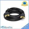
VGA Male to Male Cable 15 ft. CL2
-
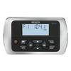
MWR150 Full Display Wired Marine Remote Control Map
-
Power Zone ORMAD5030Y Marine Y Adptr 50A Plg 30A CON
-
Power Heavy Duty Docking Replacement Light Only, Black, 12V
-
3ft 24AWG Cat5e 350MHz UTP Bare Copper Ethernet Network Cable - Purple
-
Barbour Air Cooled Power Plate PB100134
-
VHF 200 25W VHF Radio 010-00755-00
-
LHR-80 VHF/GPS Handheld Marine Radio, LHR80,22-17