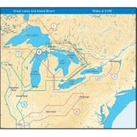
NT+ Wide Map, Ohio River: Cairo to Pittsburg NA-C039
Model: NA-C039 Brand: C-Map
C-MAP has set the standard for electronic charts with five consecutive NMEA awards for "Best Electronic Cartography". Built on the incredible success of C-MAP NT+, NT+ Wide combines a generation of chartplotters with efficient performance plus real-time accuracy and detail. Now you will be able to see slip detail as well as the locations for onshore facilities. « less
Product Specification
-
Universal Product Identifiers
Part Number: NA-C039GTIN: 00686074003989
Related Products
-
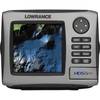
HDS-5m Nautic Insight Chartplotter - Coastal Data 34262
-
Package(c127 with USA Coastal Chart, 4KW 18 Inch Digital Radome & Radar Cable)
-
Series 50 Classic Stainless Steel Navigation Lights
-
USB 2.0 A Male to Micro-B Male Cable 3 ft.
-
USB 2.0 A Male to Micro-B Male Cable 6 ft.
-
Cat6, UTP, Bulk Cable, Stranded, 500MHz, Yellow, 1000 ft
-
6ft 24AWG CL2 Silver Plated High Speed HDMI Cable - Black
-
2018BP-24 24V Black T-Motor Plug
-
PHM1 Male Phone Plug
-
Marine Products Plug Wire Set 9-28038
-
CA50/200 12M HIGH-PERFORMANCE Bronze Thru-Hull Transducer
-
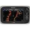
E62355 - e7D, 7 GPS/MFD/Sonar w/o Charts