PAPR08; Region 8 Paper Chart Kit
Model: PAPR08 Brand: Maptech
ChartKits are full-color reproductions of U.S. government and private charts spiral bound into popular cruising regions with aerial photos, pre-plotted courses and more. The convenient-sized books are large enough to allow for manual plotting, yet small enough to sit on your nav-station or lap. Waterproof covers are available. « less
Product Specification
-
Universal Product Identifiers
Part Number: PAPR08
Related Products
-
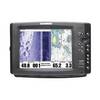
1100 Series 1197c SI Combo NVB - Fishfinder - included transducer : XHS-9-HDSI-180-T - dual-beam
-
Radar Mount, Edson Basic Fixed Flybridge Tower System for 8 to 16 Mile Radars
-
04-4006-000 Power I/O Cable f/Chart Master 11 & V6 Series
-
WPC046; Lii Egg Int NJ to Fnwk Isl de
-
Hydrostatic Release Kit - 9490
-
Methods and Algorithms in Navigation: Marine Navigation and Safety of Sea Transportation [Book]
-
Navigational Systems and Simulators: Marine Navigation and Safety of Sea Transportation [Book]
-
80A Adapter-15/20A Str-20A Lockin
-
5266CR 15A 125V 2P 3W SB Plug CR
-
100ft 24AWG Cat6 550mhz UTP Ethernet Bare Copper Network
-
GPSMAP 421 - Marine Chartplotter - 4" color - 240 x 320
-
700 Series 785c2 - Marine Chartplotter - 5" color - 480 x 640