Sea Charts of the British Isles: A Voyage of Discovery Around Britain & Ireland's Coastline [Book]
Sea Charts of the British Isles takes the reader on a voyage through the seaports, fishing and commercial harbors, naval bases and dockyards, and sea-side havens that have always supported local life in Britain and contributed to the Isles’ defense. This beautiful collection of charts contains a wealth of information about Britain’s maritime history, as well as the history of charting and surveying. The great names in British chart-making are all included, from Captain Greenvile Collins and Professor Murdoch Mackenzie to Graeme Spence and William Bligh. « less
Product Specification
-
Authors: John Blake, Lie, John Blake (Lieutenant Commander.)Pages: 128Format: hardbackPublication Date: November 19, 2005Key Terms: British Crown Copyright, Trinity House, Royal Navy, British Library, Scotland, British Isles, Admiralty, River Tyne, portolan charts, compass rose, Portland Bill, Pembrokeshire, South Ronaldsay, Isle of Wight, Lowestoft, River Thames, King's Lynn, Pentland Firth, Firth of Clyde, English Channel
-
Universal Product Identifiers
ISBN: 1844860248GTIN: 09781844860241
Related Products
-
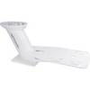
PMA-DM1-M2 12.5" Dual Mount f/Most Radar Domes - Top F/sa
-
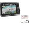
Package(e95 with aus, NZ, S. America, Asia Chart, 4KW 24 Inch Digital Radome & Radar Cable)
-
010-C0795-10 Bluechart G2 HEU451SLigurian Sea Corsica
-
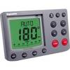
AP50 02 Autopilot System - AP50 2 Autopilot
-
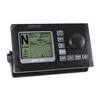
E12099-P M ST7002 Plus Control Head Surface Mount
-
5ft 24AWG Cat5e 350MHz UTP Bare Copper Ethernet Network Cable - Orange
-
50ft RG6 (18AWG) 75OHM, Quad Shield, CL2 Coaxial Cable with F Type Connector - Black
-
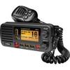
um415 Oceanus D Marine Radio (Black)
-
HBL61CM22 - Straight Marine Adapter, 5-15P, L5-30R
-
55-0023 Transom Adaptor - 550012/21/22
-
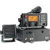
M802 Marine SSB Radio Clear / Ice / Red / Tan
-
Marine network cable