The Sea Chart: The Illustrated History of Nautical Maps and Navigational Charts [Book]
Product Specification
-
Authors: John BlakePages: 160Format: paperbackPublication Date: July 1, 2009Key Terms: British Crown Copyright, portolan chart, rhumb lines, Admiralty, Pepys Library, Spice Islands, Australia, Royal Geographical Society, compass rose, Portuguese, Alexander Dalrymple, Cape Horn, Francis Beaufort, North America, James Cook, George Vancouver, Royal Navy, Samuel Wallis, Weddell Sea, Nootka Sound
-
Universal Product Identifiers
ISBN: 1844860639GTIN: 09781844860630
Related Products
-
AP5012 Autopilot with AP50, J50, Rudder Feedback RF300, HLD2000LS (Long Stroke Split)
-
RSB0070-059 24 rpm Gearbox with 6.0 KW Transceiver
-
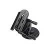
Marine Mount - GPS receiver mount bracket
-
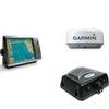
Radar 4012 Package with GMR24HD 4KW Radome & GSD22 Sounder
-
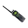
ATLANTIS 250 VHF Two-way radio
-
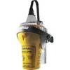
EPIRB with GPS Manual Release Cat II EG50 Manual c30588
-
E15026 Life Tag Wireless Man Overboard System (Extra Tags)
-
Serial cable - (DB-37) - M - (DB-37) - F - 10 ft - PC
-
3349810; Tank Fitting Honda 3/8 Inch Female 1991+
-
Marine Products Plug Wire Set 9-28053
-
B75-0-M Broadband Chirp 0 Degree Tilt, No CONNECTOR, Depth & Temperature Thru-Hull Tilted
-
Whisper 80' Guyed Tower Kit (Whi100/Whi200) (does Not Include Pipe & Anchors)