Waterproof Chart Kit - New Jersey Coast #WPB0360-02
Model: WPB0360-02 Brand: Maptech
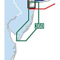
Waterproof Charts w/ Companion CD WPB0360 360: New Jersey Coast New York Harbor to Cape May, NJ. 24 chart pages. Features GPS waypoints, Lat. /Long. grids, pre-plotted courses, ramps, and 425 marine facilities. 12 x 17, scales 1:1,263,000 to 1:15,000. Product Overview These easy-to-use, compact chart books are ideal for Day-Sailors, Fishing Boats, and Trailer Boats. They measure 12 x 17 (24 x 17 when open) and are made of waterproof, tear-resistant synthetic paper that will withstand the elements. GPS Ready New features make Waterproof Chartbooks easy to use with your GPS. Most charts include one-minute lat./long. grids to make vessel positioning a breeze, and major navigation aids are identified with named GPS waypoints. Small and Large-Scale Charts Waterproof Chartbooks include small-scale, wide area charts as well as large-scale, detailed charts of harbors and approaches. The Chart Page Index « less
Product Specification
-
Universal Product Identifiers
Part Number: WPB0360-02
Related Products
-
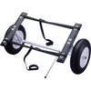
1465 16" x 4" Boat Dolly RD4
-
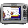
HDS-8 Insight USA w/o Ducer 140-39
-
AS-M205 C-Card Format Philippines
-
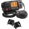
MRF80B VHF Two-way radio
-
hi731352 Plastic Tip Set for 2000 L Graduated
-
25ft 24AWG Cat5e 350MHz UTP Bare Copper Ethernet Network Cable - Orange
-
1447 3ft Optical Toslink 5.0mm OD Audio Cable
-
35ft 18AWG CL2 Premium 5-rca Component Video/audio Coaxial Cable (RG-6/U) - Black
-
P32-200-VDO 250W 200kHz Transom Mount Triducer VDO No Connector
-
B164-20-BL B164 20 Degree Tilted Element Transducer - Blue Co
-
Barbour Air Cooled Power Plate PB100134
-
Eclipse DSC GX1000 - VHF Marine Radio