Waterproof Chart Kit - San Juan Islands #WPB1510-02
Model: WPB1510-02 Brand: Maptech
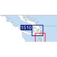
Waterproof Charts w/ Companion CD WPB1510 1510: San Juan Islands Whidbey Island and Bellingham to Boundary Pass. 23 pages of charts, 130 GPS waypoints, Lat. /Long. grids, courses, ramps, and marine facilities. Overview and detailed pass and harbor charts. 12 x 17, scales 1:200,000 to 1:20,000 Product Overview These easy-to-use, compact chart books are ideal for Day-Sailors, Fishing Boats, and Trailer Boats. They measure 12 x 17 (24 x 17 when open) and are made of waterproof, tear-resistant synthetic paper that will withstand the elements. GPS Ready New features make Waterproof Chartbooks easy to use with your GPS. Most charts include one-minute lat./long. grids to make vessel positioning a breeze, and major navigation aids are identified with named GPS waypoints. Small and Large-Scale Charts Waterproof Chartbooks include small-scale, wide area charts as well as large-scale, detailed charts of ha « less
Product Specification
-
Universal Product Identifiers
Part Number: WPB1510-02
Related Products
-
Radar 4212 Package with GMR18 4KW Radome
-
Radar 4008 Package with GMR24HD 4KW Radome & GSD22 Sounder
-
M504 Remote Mic Version - Black
-
RS-C209 C-Card Format - White Sea Barents Sea East F
-
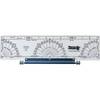
120 Marine Navigation Parallel Plotter
-
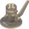
1" Seacock Body
-
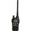
MID-NAUTICO3VP Marine Radio Nautico 3VP
-
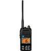
Standard HX370S Hand Held VHF - HX370S
-
93881 ACR GPS Interface Cable for 2874 Sat 3 EPIRB
-
9507 Quickdraw Cat II EPIRB Bracket FITS RLB 36 37
-
1.5ft Premium 2 RCA Plug/2 RCA Plug M/M 22AWG Cable - Black
-
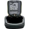
PiranhaMAX 210 Portable - Fishfinder - portable - included transducer : XNT-9-20-T - single-beam