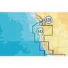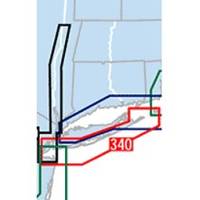
Waterproof Chart Kit - South Shore Long Island #WPB0340-02
Model: WPB0340-02 Brand: Maptech
Waterproof Charts w/ Companion CD WPB0340 340: South Shore Long Island NY Harbor's Lower Bay to Montauk and Block Island. 25 chart pages, GPS waypoints, Lat. /Long. grids, pre-plotted courses, ramps, and 340 marine facilities. 12 x 17, scales 1:1,263,000 to 1:26,000. Product Overview These easy-to-use, compact chart books are ideal for Day-Sailors, Fishing Boats, and Trailer Boats. They measure 12 x 17 (24 x 17 when open) and are made of waterproof, tear-resistant synthetic paper that will withstand the elements. GPS Ready New features make Waterproof Chartbooks easy to use with your GPS. Most charts include one-minute lat./long. grids to make vessel positioning a breeze, and major navigation aids are identified with named GPS waypoints. Small and Large-Scale Charts Waterproof Chartbooks include small-scale, wide area charts as well as large-scale, detailed charts of harbors and approaches. « less
Product Specification
-
Universal Product Identifiers
Part Number: WPB0340-02
Related Products
-
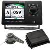
AP5013 Autopilot with AP50, J50, Rudder Feedback RF300, HLD2000SD (Short Stroke, Dual)
-
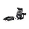
GPS receiver marine mount bracket
-
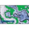
WPC076; Chart Book Booths Bay Maine
-
LMB-F2 F/ Sitex Simrad et Al Domes 36044
-
MSD/643P+ Platinum Plus Oregon & California - SD/Micro SD
-
HPILIAC2 - Map, Great Plains Edition, Electroni
-
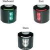
Series 43 White LED Navigation Light Port
-
000-10577-001 AP70 Autopilot Pack w/AP70, AC70, RF300 & Require
-
30ft 24AWG Cat5e 350MHz UTP Bare Copper Ethernet Network Cable - Blue
-
10ft Premium 2.5mm Stereo Male to 2rca Male 22AWG Cable 5607
-
Serial cable - (DB-37) - M - 10 ft - PC
-
HBL64CM55 Y Adapter 2 50A 125V Cords - 50A 250V