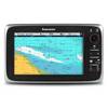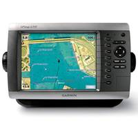
GPSMAP 4208 Network Chartplotter with U.S. Coastal Detail Map, 8.4"
Model: 4208 Brand: Garmin
Product Specification
-
Specifications
Accepts Data Cards: YesAntenna: ExternalApplication: Marine NavigationBattery Life: No BatteryBattery Type: No BatteryCartography: US CoastalDimensions: 11.2"W x 7.0"H x 4.6"DDisplay Resolution: 640 x 480Display Size: 8.4"Functions: Network DisplayInterface: NMEA 0183, NMEA 2000Maximum Depth: Depends on network equipmentMount: TiltRadio Included?: Yes, with additional receiverResolution/Color: Color VGAScreen Aspect: HorizontalTouch Screen: Not TouchscreenTurn By Turn Navigation: NoWarranty: 1 YearWaterproof: IPX7
Related Products
-
c-Series c95 Network Multi-function Display with Wireless Capability, 9" Screen, US Coastal Chart
-
HDS-7 Gen2 Fishfinder
-
c-Series c125 Network Multi-function Display with Wireless Capability, 12.1" Screen, Rest of World Charts
-
NSE8 - Chartplotter / Multifunction Display
-
Elite-4M Chartplotter
-
e165 Multi Function Display, Europe Chart
-
MO15F Monitor 15" 3mm Flange Mount
-
Analogue TWA 360 Display
-
NSE12 - Chartplotter / Multifunction Display
-
15" Hi-Bright LED Backlit Monitor with Remote Keypad
-
e-Series e125 Network Multi-function Display with Wireless Capability, 12.1" Diagonal, US Inland Chart
-
MO19F Monitor 19" 3mm Flange Mount