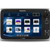
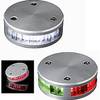
010-C0728-10 Bluechart G2 HUS027RHawaiian Islands Mariana
Model: 010-C0728-10 Brand: Garmin
Coverage of the Pacific Ocean from the Hawaiian to Mariana Islands. Includes coverage of Guam, Midway, and Johnston Atoll. General coverage of Palmyra Atoll and the Marshall Islands also included. See your surroundings more clearly with BlueChart g2 data. With BlueChart g2, you'll get detailed marine cartography that provides convenient viewing of nautical content. BlueChart g2 allows you to see your vessel's precise, on-chart position in relation to naviads, coastal features, anchorages, obstructions, waterways, restricted areas and more. You will also have access to detailed mapping capabilities that include Safety Shading , Fishing Charts , smooth data transition between zoom levels, harmonious transition across chart borders, and reduction of chart discontinuities. « less
Product Specification
-
Universal Product Identifiers
Part Numbers: 010-C0728-10, 10469849, 35558, GAR010C072810GTIN: 00753759089290
Related Products
-
The Boaters Guide to Using Marine Radar [DVD]
-
EW-C209 Furuno FP Format - Irish Sea
-
T70056 E125 Multifunction Display w/US Inland Charts
-
010-C0877-10 Bluechart G2 HAE002RYellow Sea Data Card
-
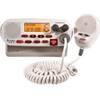
Mr F45-D Marine Digital Selective Calling Technology Fixed Mount VHF Radio - White
-
LED Stern Transom Mount Black ASL-335027
-
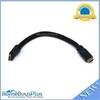
1ft 24AWG CL2 High Speed HDMI Cable w/ Net Jacket - Black
-
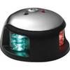
3520-7 LED Red Green, Deck Mount Navigation Light
-
LED Navigation Lights Two Nautical Mile Stern Light, 135
-
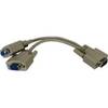
04-1092-000R Standard VGA Cable Splitter
-
PP118DP Push Plug for 1-1/8 & 1-1/4
-
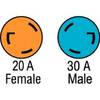
F3020ADSS Adapter,30A M to 20A F