010-C0751-10 Bluechart G2 HAF451SNamibia to Knysna Sa Data
Model: 010-C0751-10 Brand: Garmin
Coverage of the southwestern coast of Africa from Cape Ponta-Grossa in Angola through Knysa, S. Including detailed coverage of Walvis Bay, Nam., as well as Port Nolloth, Hondelklipbaais, and Cape Town, S. Detailed coverage also includes the island of St. Helena, the Tristan da Cunha Group, and Gough Island. See your surroundings more clearly with BlueChart g2 data. With BlueChart g2, you'll get detailed marine cartography that provides convenient viewing of nautical content. BlueChart g2 allows you to see your vessel's precise, on-chart position in relation to naviads, coastal features, anchorages, obstructions, waterways, restricted areas and more. You will also have access to detailed mapping capabilities that include Safety Shading , Fishing Charts , smooth data transition between zoom levels, harmonious transition across chart borders, and reduction of chart discontinuities. « less
Product Specification
-
Universal Product Identifiers
Part Numbers: 010-C0751-10, 10804623, 35583GTIN: 00753759089719
Related Products
-
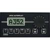
AP-35 Pack 3 Pilot AP35,J300X-40,RF300,RC25
-
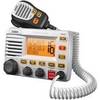
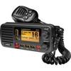
UM-525 GPS Intuitive Fixed Mount VHF/Loud Hailer Marine Radio - White
-
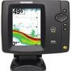
500 Series 586c - Fishfinder - included transducer : XNT-9-20-T - dual-beam
-
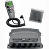
VHF 300i ais, International Garmin 10972206
-
Max EN-M604 W34 Russian Lakes-MAX
-
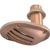
1.25" Intake Strainer
-
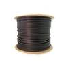
Bulk cable - CAT 5e - Shielded twisted pair (STP) 1000 ft - Black
-
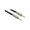
20' 1/4" Phone Male to 1/4" Phone Male Speaker Cable, 14 Awg, with 2 Conductors
-
um415 Oceanus D Marine Radio (Black)
-
Twist-Lock Power adapter - PC
-
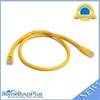
2ft 24AWG Cat6 550mhz UTP Ethernet Bare Copper Network Cable - Yellow
-
1852069 Adapter Cable Lowrance 6 Pin