010-C0765-10 Bluechart G2 HEU006RScotland West Coast Data
Model: 010-C0765-10 Brand: Garmin
See More of Your Surroundings See your surroundings more clearly with BlueChart g2 data. With BlueChart g2, you ll get detailed marine cartography that provides convenient viewing of nautical content. BlueChart g2 allows you to see your vessel s precise, on-chart position in relation to navaids, coastal features, anchorages, obstructions, waterways, restricted areas and more. You will also have access to detailed mapping capabilities that include Safety Shading , Fishing Charts , smooth data transition between zoom levels, harmonious transition across chart borders, and reduction of chart discontinuities. Realistic navigation features showing everything from shaded depth contours and coastlines to spot soundings, navaids, port plans, wrecks, obstructions, intertidal zones, restricted areas, IALA symbols and more. Smooth display presentation including seamless transitioning between zoom levels and more continuity across chart boundaries. Safety Shading allows user to enable contour shading for all depth contours shallower than user-defined safe depth. Fishing charts to help scope out bottom contours and depth soundings with less visual clutter on the display. Choice of standard 2-D direct overhead or 3-D "over the bow" map perspective to make chart reading and orientation easier. Compatible with HomePort - software that lets you use BlueChart data to conveniently plan and organize routes from your computer before your trip. « less
Product Specification
-
Universal Product Identifiers
Part Numbers: 010-C0765-10, 10804888, 35603GTIN: 00753759091538
Related Products
-
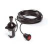
Autopilot Joystick Kit 54500060
-
SP-70MT Autopilot for Cable Steer Tilt Type Helms st70mt
-
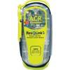
2881 ResQLink + 406MHz GPS PLB Buoyant
-
Package(c97 with aus, NZ, S. America, Asia Chart, 4KW 24 Inch Digital Radome & Radar Cable)
-
CF651P Central Gulf of MX Plat+ on CF
-
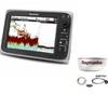
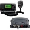
VHF 100 & AIS 300 Marine Communication Bundle K10-00169-00
-
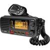
Ite-unnum415bk-ptrind1 Um415Oceanus D Marine Radio
-
Marine World Chart of Nicolo de Canerio Januensis [Book]
-
1ft 24AWG Cat5e 350MHz UTP Bare Copper Ethernet Network Cable - Blue
-
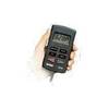
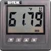
SST110 Surface Temp with Out Sensor
-
4163 30ft 24AWG CL2 Flat Standard HDMI Cable - Black
-
Marine Radio Two Way VHF