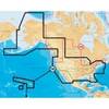
010-C0877-10 Bluechart G2 HAE002RYellow Sea Data Card
Model: 010-C0877-10 Brand: Garmin
HAE002R Covers: General coverage of the Chinese coast from Wenzhou to Dandong, the North and South Korean coasts in their entirety, and the Russian coast east to Nakhodka. Also includes general coverage of the southern tip of Japan from Yonago around to Kochi. Included in this overall general coverage are numerous detailed charts covering areas in China such as Shanghai, Qingdao, and Dalian, and also Nampo, N.Kor., Pusan, S. Kor., Chongjin, N. Kor., and Nagasaki and Fukuoka in Japan. « less
Product Specification
-
Universal Product Identifiers
Part Numbers: 010-C0877-10, 10806990, 35775GTIN: 00753759090012
Related Products
-
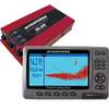
SE-200 BB Sonar w/ 7" Display & Cable No Ducers 41384
-
SM-18-U Mast Platform 12 Inch to 18 Inch Radars c16804
-
CF/1XG Gold All USA & Northern Bahamas on CF
-
Radar 15m Split Power Pedestal Cable-Radar
-
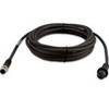
010-11419-00 - 6M Marine Heading Sensor Cable NMEA2000
-
2744.91 FBRS 2744 Battery Replacement Service
-
010-C1002-20 Bluechart G2 HXEU059RGreenland East Microsd/sd ADA
-
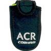
9521 Floating Pouch f/ResQLink
-
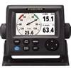
RD33 4. 3 in. Color LCD Navigational Data Organizer
-
PL-258-L-G Bulkhead Barrell Connector for PL-259
-
3878-3 Double-Ended Thru-Hull Connector
-
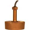
CA50/200 12M HIGH-PERFORMANCE Bronze Thru-Hull Transducer