010-C1020-10 Bluechart G2 HPC024RAustralia & New Zealand Data
Model: 010-C1020-10 Brand: Garmin
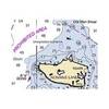
See your surroundings more clearly with BlueChart g2 data. With BlueChart g2, you'll get detailed marine cartography that provides convenient viewing of nautical content. BlueChart g2 allows you to see your vessel's precise, on-chart position in relation to naviads, coastal features, anchorages, obstructions, waterways, restricted areas and more. You will also have access to detailed mapping capabilities that include Safety Shading, Fishing Charts, smooth data transition between zoom levels, harmonious transition across chart borders, and reduction of chart discontinuities. Covers: Detailed coverage of the entire continent of Australia and New Zealand. Coverage includes Brisbane, Sydney, and the Great Barrier Reef along the Eastern coast. Coverage continues along the Southern coast including Melbourne, Adelaide, and Tasmania through the Great Australian Bight. Coverage also includes Perth, Geraldton, Darwin, and the Gulf of Carpentaria on the Western and Northern coasts. « less
Product Specification
-
Universal Product Identifiers
Part Numbers: 010-C1020-10, 10807220, 35813GTIN: 00753759095482
Related Products
-
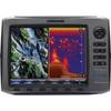
HDS-10 No Transducer - 140-41
-
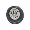
Digital Guages LST-3800 - Depth sounder - included transducer : Skimmer
-
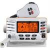
Explorer GX1700W GPS Fixed Mount VHF - White
-
NOAA Rosario Strait-Southern Part Chart
-
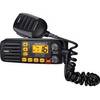
SOLARA-DSC Black Solara Compact Fixed Mount VHF 2-Way Marine Radio - Black
-
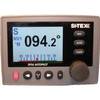
SP36-1 Autopilot Rate Compass with No Drive
-
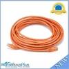
25ft 24AWG Cat5e 350MHz UTP Bare Copper Ethernet Network Cable - Orange
-
T-H Marine TH7592B; 3/4 90 Degree Thru-Hull White Fitting
-
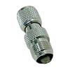
da-da572 Mini-UHF Male to TNC Female Adapter
-
Flush Mount Utility Light 401515-1 Screw Mount
-
Cat6a Ethernet Cable | 2ft | Blue | Network | 10 Gigabit
-
Hand Held VHF Radio HX280S